Ma On Shan
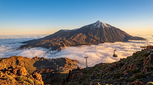
A sharp peak above Sha Tin with a grassy plateau below it used by paragliders.
Updated 19 October 2026
Ma On Shan reaches 702 metres between Sha Tin and Sai Kung, and its name, saddle mountain, comes from the dip between its two summits seen from the west. It is one of the more genuinely mountainous walks in Hong Kong, with a rocky ridge, exposed sections and a real sense of height above the Tolo Harbour on one side and the Sai Kung country parks on the other. Below the peak lies Ngong Ping, a grass plateau that is one of the main paragliding launch sites in the territory and a popular camping spot, reached on a path from Ma On Shan village. An abandoned iron mine and its village stand on the lower slopes.
History
Deep inside the slope of Ma On Shan was an iron mine, its deposit estimated at more than 7 million tonnes, whose ore from the 1950s to the 1970s went mainly to Japan; it closed in 1976 because it no longer paid, with the energy crisis of the 1970s and the new town spreading below. The old Ma On Shan Village still houses around 80 families, and Yan Kwong Lutheran Church, one of two churches from the mining years, was revived around 2014 as a centre for the village's history (Wikipedia, Ma On Shan (town)).
Highlights
- The saddle between two summits - the shape the mountain is named for.
- The Ngong Ping grass plateau - paragliding launches and camping ground.
- The abandoned iron mine - workings and village on the lower slopes.
- Views over Tolo Harbour and Sai Kung - country in both directions.
When to go
October to April; summer heat on the exposed ridge is dangerous. A day. The ridge is not a walk for anyone uncomfortable with exposure. Start early and carry water.
What to expect
The final ridge is exposed with steep drops and requires hands in places. There is no water on the route. Cloud closes in fast on the summit. The mine site is unstable and entering the workings is unsafe.
Nearby
Sai Kung is east; Sha Tin lies west.
What to pack for Ma On Shan
Chosen from what this place is for. Tap a kit for the full checklist.
- Broken-in walking shoes or boots - Grip and ankle support matter more than looks; never hike in brand-new boots. Find on Amazon
- Layers for big temperature swings - Warm sun by day, near-freezing at night, even near the equator. Find on Amazon
- Shelter suited to the place - Tent, tarp or hut booking - match it to the terrain and rules. Find on Amazon
- Layers + a waterproof shell - Mountain weather turns fast; a packable rain jacket saves the day. Find on Amazon
Some links on this page are Amazon affiliate links - if you buy through them we may earn a small commission at no extra cost to you.
All packing kitsPlan your trip
Where to start if Ma On Shan is going on the list.
Booking links on this page are affiliate links - if you book through them we may earn a small commission at no extra cost to you. It never changes what we write about a place.
Opening times, ticket prices and seasonal closures change - check the official source before you go: official site.