Mount Kakoulima
A flat-topped massif northeast of Conakry, visible from the capital and climbed from Coyah.
Updated 3 September 2026
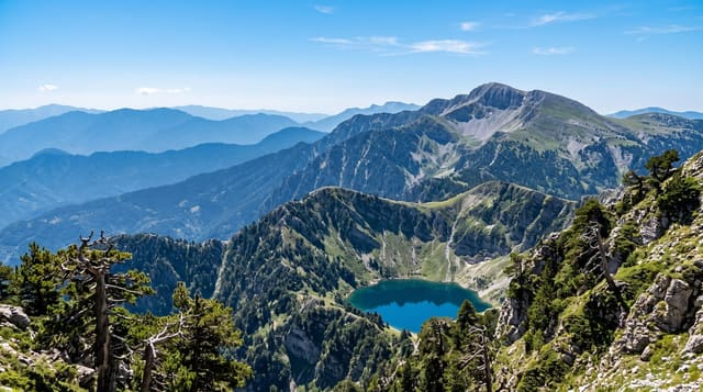
Mount Kakoulima rises to around a thousand metres northeast of Conakry, a flat-topped massif of dark rock that dominates the skyline from the capital and the coastal plain, and it can be climbed in a long day from the villages on its flanks. The route goes up through farmland and then forest and scrub onto the plateau top. From the summit the coast, the islands and Conakry are laid out.
The landscape
- The flat top - the plateau summit the massif is shaped by.
- The coastal view - Conakry, the coast and the islands from the top.
- The climb - the route up through farmland, forest and scrub.
- The skyline presence - a mountain visible from across the capital.
When to go
November to April is the dry season and the practical window. The rains make the route slippery and dangerous. Harmattan haze can cut the view.
Things to know
The climb is long and steep with no marked path; a guide from the villages is needed. There is no water on the route. Haze often closes the view over the coast.
Nearby
Coyah is below, and Conakry is southwest.
Key facts
Source: Wikidata, item Q24850744, read on 18 October 2026.
What to pack for Mount Kakoulima
Chosen from what this place is for. Tap a kit for the full checklist.
- Broken-in walking shoes or boots - Grip and ankle support matter more than looks; never hike in brand-new boots. Find on Amazon
- Layers for big temperature swings - Warm sun by day, near-freezing at night, even near the equator. Find on Amazon
- Layers + a waterproof shell - Mountain weather turns fast; a packable rain jacket saves the day. Find on Amazon
- Extra-strong sun protection - Thin air means fierce UV; hat, sunglasses and high-SPF sunscreen. Find on Amazon
Some links on this page are Amazon affiliate links - if you buy through them we may earn a small commission at no extra cost to you.
All packing kitsPlan your trip
Where to start if Mount Kakoulima is going on the list.
Booking links on this page are affiliate links - if you book through them we may earn a small commission at no extra cost to you. It never changes what we write about a place.
Opening times, ticket prices and seasonal closures change - check the official source before you go: official site.