Sierra de los Cuchumatanes
A high limestone plateau in Huehuetenango, the highest non-volcanic ground in Central America.
Updated 19 October 2026
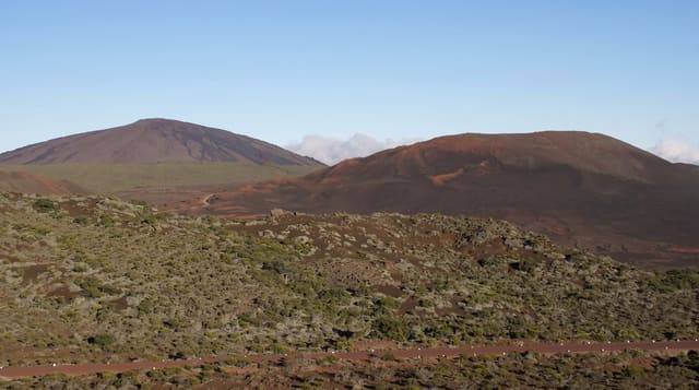
The Cuchumatanes rise north of Huehuetenango to a broad plateau above three thousand metres, reaching close to three thousand eight hundred at its highest, which makes it the highest non-volcanic ground in Central America. The landscape up there is unlike the rest of the country: open pasture and limestone outcrops, stone walls, scattered pines, sheep, and villages of the Mam and other communities where dress and language mark each town apart. The road climbs steeply from Huehuetenango to a viewpoint at the plateau edge and then runs north across it to Todos Santos and beyond. It is cold, bright and frequently above the cloud filling the valleys below.
History
The name may come from the Mam cuchuj, "to join", and matán, "with superior force", or from the Nahuatl kochmatlán, "place of the parrot hunters". Historians believe the range and the Altos de Chiantla had few permanent residents before the Spanish came, and that people may have planted potatoes there and returned only when needed, though it is not certain whether potatoes reached the mountains before the Spanish (Wikipedia, Sierra de los Cuchumatanes).
Highlights
- The plateau above three thousand metres - open high ground and limestone.
- Stone walls and grazing sheep - the pastoral landscape on top.
- Villages with distinct dress - each town identifiable by its weaving.
- Cloud filling the valleys below - the view from the plateau edge.
When to go
November to April in the dry season; nights are freezing and frost is normal on the plateau. Two to four days to see it properly. Buses run but are slow.
What to expect
It is genuinely cold and visitors arrive underdressed for altitude. Roads are winding and slow, and rough beyond the main routes. Accommodation is basic. Altitude affects people coming up quickly from the coast.
Nearby
Huehuetenango is south; Todos Santos lies on the plateau.
Key facts
Source: Wikidata, item Q1660972, read on 18 October 2026.
What to pack for Sierra de los Cuchumatanes
Chosen from what this place is for. Tap a kit for the full checklist.
- Broken-in walking shoes or boots - Grip and ankle support matter more than looks; never hike in brand-new boots. Find on Amazon
- Layers for big temperature swings - Warm sun by day, near-freezing at night, even near the equator. Find on Amazon
- Layers + a waterproof shell - Mountain weather turns fast; a packable rain jacket saves the day. Find on Amazon
- Extra-strong sun protection - Thin air means fierce UV; hat, sunglasses and high-SPF sunscreen. Find on Amazon
Some links on this page are Amazon affiliate links - if you buy through them we may earn a small commission at no extra cost to you.
All packing kitsPlan your trip
Where to start if Sierra de los Cuchumatanes is going on the list.
Booking links on this page are affiliate links - if you book through them we may earn a small commission at no extra cost to you. It never changes what we write about a place.
Opening times, ticket prices and seasonal closures change - check the official source before you go: official site.