Candelaria Caves
A long river cave system in Alta Verapaz, floated through on rubber rings.
Updated 19 October 2026
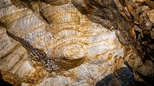
The Candelaria system runs for many kilometres through limestone in northern Alta Verapaz, carrying a river through a sequence of chambers, some of them very large, with skylights where the roof has collapsed letting shafts of daylight fall onto the water and vegetation growing down into the openings. The Maya used the caves, and pottery, hearths and ceremonial deposits have been found through the system. Several entrances are managed by different communities and by a private operation, each offering something different: dry walks through chambers, or floating stretches of the river on rubber rings through the dark, which is what most visitors come for.
History
The Great Western Trade Route of the Classic Maya, linking the Guatemalan highlands with the Petén lowlands, passed through the Candelaria area, and pottery and rock paintings show the caves were used for ceremonies. The Popol Vuh of the K'iche' people describes the caves as an entrance to the underworld, and some are still used for Maya celebrations (Wikipedia, Candelaria Caves).
What's there
- Floating the underground river - drifting through the chambers on rings.
- Skylights and light shafts - daylight falling where the roof has collapsed.
- Very large chambers - the scale of the main passages.
- Evidence of Maya use - pottery and ceremonial deposits in the caves.
When to go
January to April in the dry season; water levels in the rains can make the river sections unsafe or impossible. Half a day. Different entrances are run separately, so ask what each includes.
Things to know
Which sections are open depends on water levels and on which entrance you use. Operations vary in quality and safety standards. Floating the river is cold and dark and not for everyone. Getting there needs a vehicle or an organised trip.
Nearby
Raxruha is east; Cancuen lies north-east.
Key facts
Source: Wikidata, item Q5031651, read on 18 October 2026.
What to pack for Candelaria Caves
Chosen from what this place is for. Tap a kit for the full checklist.
- Head torch + spare batteries - Hands-free light is essential; caves are truly dark. Find on Amazon
- Grippy closed shoes - Cave floors are wet, muddy and slick with formations. Find on Amazon
- A warm layer - Many caves sit near 10°C year-round, even in a hot country. Find on Amazon
- Gloves - Protect your hands on rough rock and cold metal handrails. Find on Amazon
Some links on this page are Amazon affiliate links - if you buy through them we may earn a small commission at no extra cost to you.
All packing kitsPlan your trip
Where to start if Candelaria Caves is going on the list.
Booking links on this page are affiliate links - if you book through them we may earn a small commission at no extra cost to you. It never changes what we write about a place.
Opening times, ticket prices and seasonal closures change - check the official source before you go: official site.