Tanguisson Beach
A northern beach with limestone pillars standing in the water, below an old power plant.
Updated 3 September 2026
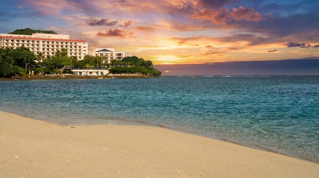
Tanguisson on Guam's northwestern coast is known for the limestone pillars standing in the shallows off the beach, eroded stacks left where the rest of the shelf has worn away, and for being the start of the walk north along the coast toward Lost Pond and the sea cliffs. A disused power station stands behind it. The sand is coarse and the water shallow over the reef flat. The coastal walk north from here leads to Lost Pond, a sinkhole in the limestone that holds fresh water a short way inland.
Highlights
- The limestone pillars - eroded stacks standing in the shallow water.
- The coastal walk - the route north along the shore from the beach.
- The reef flat - the shallow shelf running out from the sand.
- The disused plant - the power station standing behind the beach.
When to go
December to June is the drier season. Tide governs how much reef flat is walkable. Weekends bring local visitors.
Practical notes
The disused power station behind is an eyesore. The reef flat is sharp and shoes are needed. Currents at the reef edge are strong.
Nearby
Tumon is south, and Ritidian is north.
Key facts
Source: Wikidata, item Q25185589, read on 18 October 2026.
What to pack for Tanguisson Beach
Chosen from what this place is for. Tap a kit for the full checklist.
- Reef-safe sunscreen - High SPF that will not bleach the coral you are swimming over. Find on Amazon
- Quick-dry towel - A microfibre towel packs small and dries in minutes. Find on Amazon
- Water shoes - Protect your feet on rocky entries, hot sand and sea-urchin spines. Find on Amazon
- Dry bag - Keeps phone, cash and keys safe while you are in the water. Find on Amazon
Some links on this page are Amazon affiliate links - if you buy through them we may earn a small commission at no extra cost to you.
All packing kitsPlan your trip
Where to start if Tanguisson Beach is going on the list.
Booking links on this page are affiliate links - if you book through them we may earn a small commission at no extra cost to you. It never changes what we write about a place.
Opening times, ticket prices and seasonal closures change - check the official source before you go: official site.