Omalos Plateau
A flat upland basin at 1,050 metres ringed by the White Mountains, the gateway to the Samaria gorge.
Updated 4 September 2026
AI illustration
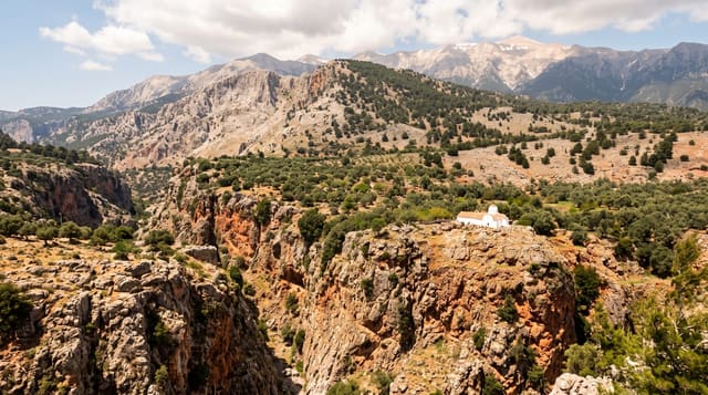
Omalos is a closed karst basin about four kilometres across, floored with flat farmland and grazing at 1,050 metres and surrounded on all sides by the White Mountains, which hold snow into late spring. Water drains from it through a sinkhole, the Tzanis chasm, rather than any river. The plateau is worked for potatoes and grazing but has almost no permanent population, and its handful of buildings serve travellers. At its southern edge the Xyloskalo staircase drops into the Samaria gorge, making Omalos the assembly point for thousands of walkers each summer morning. Roads also lead from here to the Kallergi refuge and up toward Gingilos and the high Lefka Ori peaks, which is where the serious mountain walking on Crete starts.
What you'll find
- The flat basin - farmland ringed by mountains with no outlet river.
- Xyloskalo - the stairway entrance to the Samaria gorge.
- The Kallergi refuge road - the approach to the high White Mountains.
- The spring flowers - a brief and intense bloom on the plateau floor.
When to go
May to October; the plateau is snowbound and often unreachable in winter, and the gorge opens roughly May to October. April brings flowers but the gorge may still be closed. Nights are cold even in summer.
Practical notes
There is very little at Omalos itself: a few tavernas and rooms, no shops of consequence and no attractions beyond the landscape. Buses run to the gorge entrance early and back late, with awkward timing otherwise. Mountain weather changes fast.
Nearby
The Samaria gorge descends south to Agia Roumeli; Lakki village and Chania lie down the north road.
Key facts
Source: Wikidata, item Q3351809, read on 18 October 2026.
What to pack for Omalos Plateau
Chosen from what this place is for. Tap a kit for the full checklist.
- Broken-in walking shoes or boots - Grip and ankle support matter more than looks; never hike in brand-new boots. Find on Amazon
- Warm base layers - Merino or synthetic against the skin - never cotton, which chills when damp. Find on Amazon
- Layers + a waterproof shell - Mountain weather turns fast; a packable rain jacket saves the day. Find on Amazon
- An insulated + windproof jacket - A down or synthetic layer under a hard shell handles most cold. Find on Amazon
Some links on this page are Amazon affiliate links - if you buy through them we may earn a small commission at no extra cost to you.
All packing kitsPlan your trip
Where to start if Omalos Plateau is going on the list.
Booking links on this page are affiliate links - if you book through them we may earn a small commission at no extra cost to you. It never changes what we write about a place.
Opening times, ticket prices and seasonal closures change - check the official source before you go: official site.