Andros
The greenest of the Cyclades, with running streams, shipowners' mansions and three hundred kilometres of waymarked paths.
Updated 19 October 2026

AI illustration
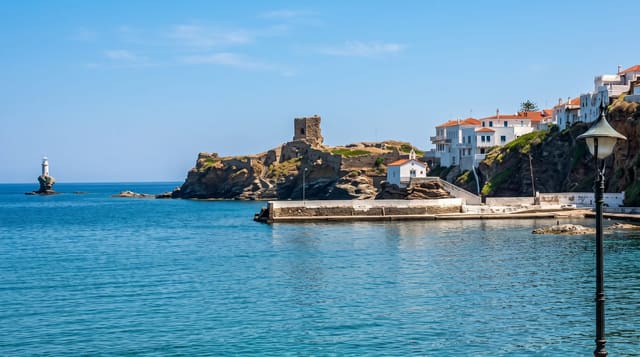
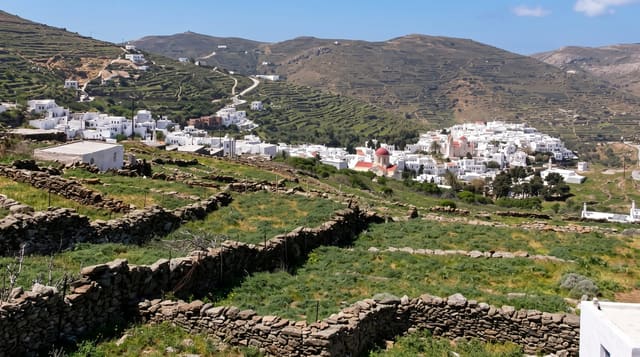
Andros is unusually wet for the Cyclades, with springs and streams that run all year, which gives it terraced valleys, plane trees and a green interior quite unlike its neighbours. Its wealth came from shipping, and the Chora reflects it: neoclassical mansions along a marble-paved main street, a small museum of modern art founded by the Goulandris shipping family with a serious collection, and an archaeological museum holding the Hermes of Andros. The island's other distinction is walking: a network of some 300 kilometres of old stone paths has been restored and waymarked as the Andros Route, certified as a Leading Quality Trail of Europe, linking villages, watermills, dovecotes and beaches. Menites has springs running from lion-head spouts, and Ateni and Achla are among the least developed beaches in the Cyclades.
History
In antiquity Andros had an Ionian population, and by the 7th century BC it was prosperous enough to found colonies in Chalcidice, among them Acanthus, Stageira, Argilus and Sane; its ancient capital, Palaeopolis, was built into a steep hillside on the west coast, where the harbour breakwater can still be seen under water. In 200 a Roman, Pergamene and Rhodian fleet captured it, and it belonged to the Attalid kingdom until 133 BC, when it passed to Rome (Wikipedia, Andros, Greece).
Highlights
- The Andros Route - 300 kilometres of restored and waymarked stone paths.
- The Chora - marble streets, shipping mansions and two good museums.
- The green valleys - streams, terraces, watermills and plane trees.
- The quiet beaches - Achla, Ateni and other undeveloped bays.
When to go
April to June and September to October, the walking seasons, when the interior is green and temperatures suit long days on the paths. August is busy with Athenian families; winter is wet and windy.
Things to know
Andros is a walker's island rather than a nightlife or beach-club destination, and visitors expecting the standard Cycladic postcard find a different, quieter place. Roads are winding, and buses limited. Some paths need proper footwear and a map.
Nearby
Tinos lies south by ferry; Rafina on the mainland is two hours away.
Key facts
Source: Wikidata, item Q175741, read on 18 October 2026.
What to pack for Andros
Chosen from what this place is for. Tap a kit for the full checklist.
- Broken-in walking shoes or boots - Grip and ankle support matter more than looks; never hike in brand-new boots. Find on Amazon
- Reef-safe sunscreen - High SPF that will not bleach the coral you are swimming over. Find on Amazon
- Layers + a waterproof shell - Mountain weather turns fast; a packable rain jacket saves the day. Find on Amazon
- Quick-dry towel - A microfibre towel packs small and dries in minutes. Find on Amazon
Some links on this page are Amazon affiliate links - if you buy through them we may earn a small commission at no extra cost to you.
All packing kitsPlan your trip
Where to start if Andros is going on the list.
Booking links on this page are affiliate links - if you book through them we may earn a small commission at no extra cost to you. It never changes what we write about a place.
Opening times, ticket prices and seasonal closures change - check the official source before you go: official site.