Georgian Military Highway
The road north from Tbilisi across the Caucasus, over the Jvari pass at 2,379 metres.
Updated 19 October 2026
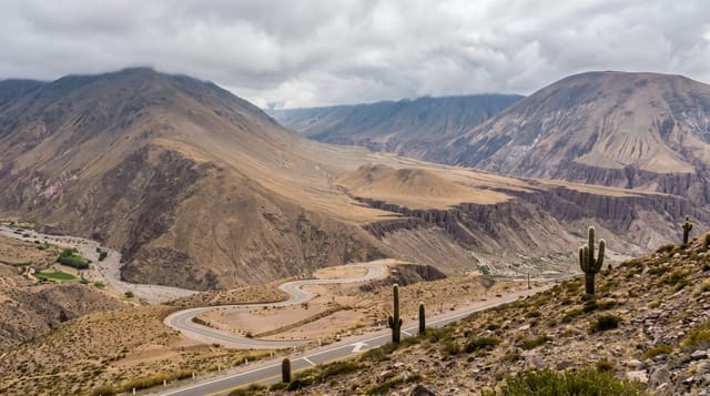
The Georgian Military Highway follows the only through route across the central Caucasus, running north from Tbilisi past Mtskheta, along the Aragvi valley and the Zhinvali reservoir, up through Pasanauri and Gudauri to the Jvari pass at two thousand three hundred and seventy-nine metres, then down the Terek valley past Stepantsminda and through the Dariali gorge to the border. It was made into a proper road in the nineteenth century along a route used for far longer. Almost everything worth stopping for in this part of the country is on it: Ananuri, the Khada valley, Gudauri, the pass viewpoint, Gergeti and Truso.
History
People have used the route since antiquity, and both Strabo and Pliny the Elder mention it. Russian troops first travelled it in 1769, and Pavel Potemkin set 800 soldiers to improve it, so that by October 1783 he could drive to Tiflis in a carriage drawn by eight horses; the road in its present form was begun by the Russian army in 1799. After 1801 General Aleksey Yermolov was ordered to improve its surface, and when he announced the work finished in 1817 it was hailed as the "Russian Simplon", though work went on until 1863; in 1876 Lord Bryce praised its quality, with two or three lanes and iron bridges over the torrents, and the road played an important part in the economic development of Transcaucasia (Wikipedia, Georgian Military Road).
What you'll find
- The Jvari pass at 2,379 metres - the crossing of the central Caucasus.
- The Aragvi valley and Zhinvali reservoir - the southern approach.
- Ananuri fortress - the walled castle above the water.
- The Terek descent to Dariali - the northern side of the pass.
When to go
May to October for a straightforward drive; the pass is open in winter but closes in storms and requires chains or winter tyres. A day each way, two with stops.
Good to know
The pass closes without warning in snow and vehicles are held for hours. Heavy lorry traffic makes overtaking dangerous. Landslides and rockfall close sections after rain. Marshrutka drivers on this road are not always cautious.
Nearby
Tbilisi is at the southern end; Stepantsminda lies below the pass.
Key facts
Source: Wikidata, item Q1342857, read on 18 October 2026.
What to pack for Georgian Military Highway
Chosen from what this place is for. Tap a kit for the full checklist.
- Broken-in walking shoes or boots - Grip and ankle support matter more than looks; never hike in brand-new boots. Find on Amazon
- Warm base layers - Merino or synthetic against the skin - never cotton, which chills when damp. Find on Amazon
- Layers + a waterproof shell - Mountain weather turns fast; a packable rain jacket saves the day. Find on Amazon
- An insulated + windproof jacket - A down or synthetic layer under a hard shell handles most cold. Find on Amazon
Some links on this page are Amazon affiliate links - if you buy through them we may earn a small commission at no extra cost to you.
All packing kitsPlan your trip
Where to start if Georgian Military Highway is going on the list.
Booking links on this page are affiliate links - if you book through them we may earn a small commission at no extra cost to you. It never changes what we write about a place.
Opening times, ticket prices and seasonal closures change - check the official source before you go: official site.