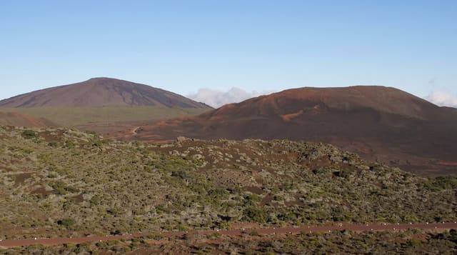
Mount Aorai
Tahiti's third highest peak, climbed on a ridge trail with two huts, taking two days from Papeete.
Updated 21 October 2026
Mount Aorai reaches 2066 metres and is the third highest point on Tahiti, and unlike Orohena it can be climbed without technical equipment on a ridge trail that runs from Le Belvédère above Papeete. The route follows a narrow arête with drops on both sides, passing two basic huts, and takes most people two days. From the top the island's interior opens up with Orohena and the old caldera visible when the cloud lifts.
The landscape
- The ridge trail - a narrow arete with drops on both sides for much of the route.
- The two huts - the basic shelters at Fare Mato and Fare Ata.
- The summit - Tahiti's third highest point at 2066 metres.
- The interior view - Orohena and the caldera from the top when clear.
When to go
May to October is the dry season and the only sensible window. Cloud closes the summit most afternoons. The ridge is dangerous in wind and rain.
Practical notes
The ridge has exposed sections with long drops and is genuinely dangerous in wet or windy weather. The huts are very basic with no water. Cloud usually closes the view.
Nearby
Papeete is north, and the Papenoo caldera is east.
What to pack for Mount Aorai
Chosen from what this place is for. Tap a kit for the full checklist.
- Broken-in walking shoes or boots - Grip and ankle support matter more than looks; never hike in brand-new boots. Find on Amazon
- Layers for big temperature swings - Warm sun by day, near-freezing at night, even near the equator. Find on Amazon
- Shelter suited to the place - Tent, tarp or hut booking - match it to the terrain and rules. Find on Amazon
- Layers + a waterproof shell - Mountain weather turns fast; a packable rain jacket saves the day. Find on Amazon
Some links on this page are Amazon affiliate links - if you buy through them we may earn a small commission at no extra cost to you.
All packing kitsPlan your trip
Where to start if Mount Aorai is going on the list.
Booking links on this page are affiliate links - if you book through them we may earn a small commission at no extra cost to you. It never changes what we write about a place.
Opening times, ticket prices and seasonal closures change - check the official source before you go: official site.