Roura
A hillside village on the Oyak river where the Kaw road begins its climb.
Updated 16 October 2026
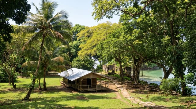
Roura climbs a low hill above the Oyak river southeast of Cayenne, a Creole village with a stone church of 1889 at the top of the slope and a view down the river toward the mangroves, and it is the last real village before the Kaw road climbs into the forest. People stop here on the way to the marshes, buy couac and juice at the roadside, and look at the river. Brazilians and Creoles farm the country around it.
Background
Jesuits founded the town of Roura in 1675. The commune around it covers approximately 3,902.5 square kilometres and also takes in the village of Cacao, set up in 1977 for Hmong farmers. Farming and eco-tourism support the local economy. Large areas are protected, among them the Kaw-Roura Marshland Nature Reserve, created in 1998 over 94,700 hectares of Roura and Régina, and the Trésor Regional Nature Reserve, 2,464 hectares on the flank of Kaw Mountain, which stands 276 metres, protected since 2010. Route nationale 2 leads on to Régina and Saint-Georges, while the RD6 runs 70 kilometres to Kaw along a forested thalweg. The commune had 3449 residents in 2023.
Source: Wikipedia, "Roura"
What to look for
- The hillside church - the 1889 stone building at the top of the village.
- The Oyak view - the river running below toward the mangroves.
- The Kaw road - the forest road beginning its climb behind the village.
- The roadside stalls - couac, fruit and juice sold along the road.
When to go
July to November is the dry season. The village works as a stop on the Kaw road year round. Sunday mornings are the liveliest.
Things to know
It is a stop rather than a destination and an hour covers the village itself. Services are few. The point is the combination with Fourgassié, Trésor and Kaw beyond.
Nearby
Fourgassié is south, and the Kaw marshes are southeast.
Key facts
Source: Wikidata, item Q996422, read on 18 October 2026.
What to pack for Roura
Chosen from what this place is for. Tap a kit for the full checklist.
- Comfortable walking shoes - Sightseeing means kilometres of pavement and cobbles daily. Find on Amazon
- A slim anti-theft daypack - Zips that close properly; keep it in front in crowds and on transit. Find on Amazon
- A refillable water bottle - Many cities have public fountains; save money and plastic. Find on Amazon
- A light layer + compact umbrella - For museum air-con and a sudden shower. Find on Amazon
Some links on this page are Amazon affiliate links - if you buy through them we may earn a small commission at no extra cost to you.
All packing kitsPlan your trip
Where to start if Roura is going on the list.
Booking links on this page are affiliate links - if you book through them we may earn a small commission at no extra cost to you. It never changes what we write about a place.
Opening times, ticket prices and seasonal closures change - check the official source before you go: official site.