Peyrepertuse
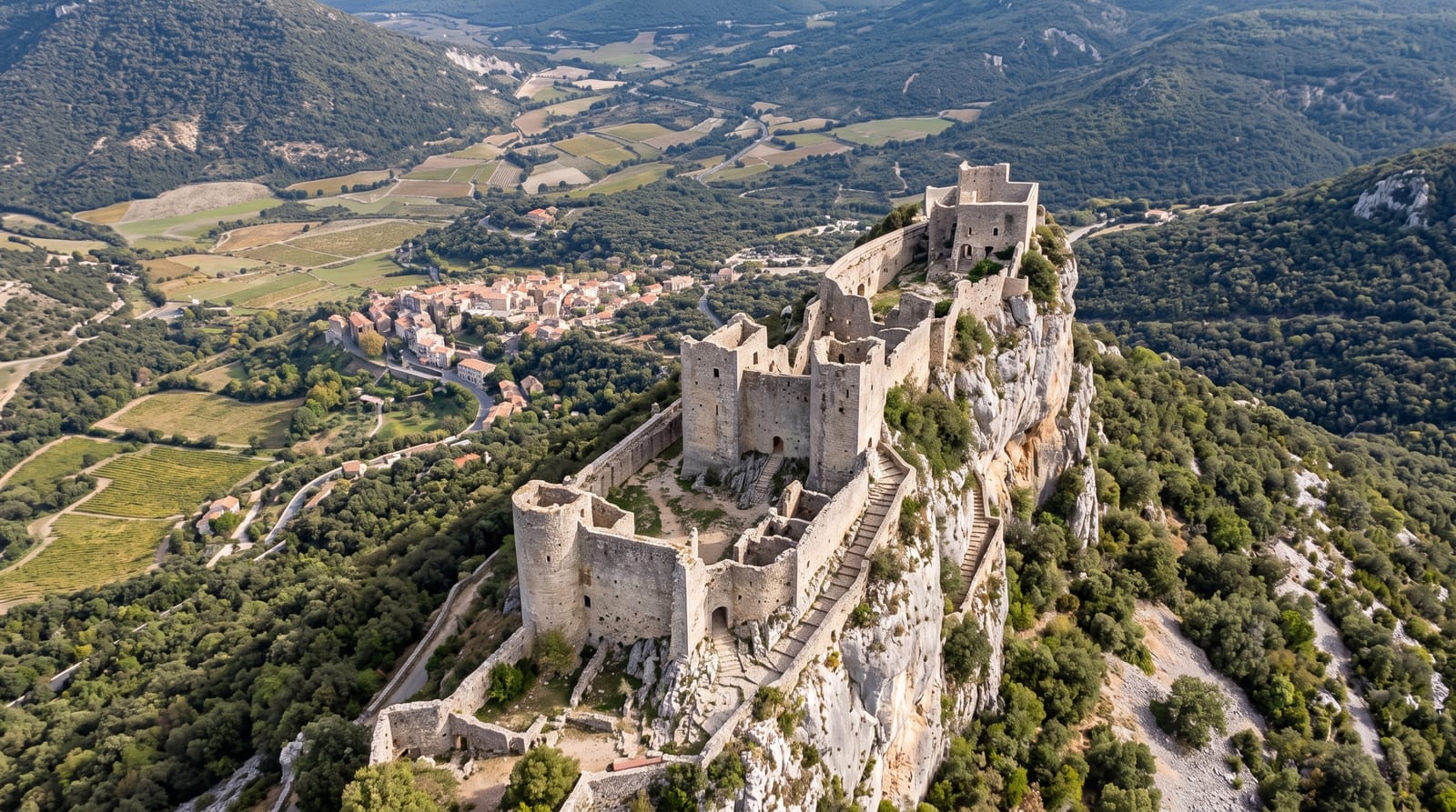
A castle three hundred metres long balanced along a limestone ridge, with a stair cut into the rock.
Updated 21 October 2026
AI illustration
UNESCO World Heritage
Peyrepertuse runs about three hundred metres along a narrow limestone crest at around eight hundred metres, and its plan simply follows the rock, widening and narrowing as the ridge does; the whole thing is roughly the footprint of the Cite of Carcassonne stretched along a knife edge. It came to France in 1240 and Louis IX rebuilt it as a frontier post against Aragon, adding the upper castle of Sant Jordi reached by the Escalier Saint-Louis, sixty steps cut straight into the rock with a drop beside them. It is one of the so-called five sons of Carcassonne, castles associated with the Cathar period.
History
The site was occupied from the 1st century BC, the castle is first recorded in 806, and in 1020 it belonged to the Catalan Count of Besalú, passing to Barcelona in 1111 and then to the Viscounts of Narbonne. It became French in 1240, and Louis IX reinforced it from 1242, adding the Sant Jordi keep higher on the ridge in 1250-1251; the Treaty of Corbeil of 1258 fixed the border just south of it, and it stayed a royal frontier fortress until the Treaty of the Pyrenees of 1659 moved the border some 60 km south. A small garrison stayed until the Revolution, the ruins were sold in 1820, listed as a monument historique in 1908, and in July 2026 inscribed by UNESCO among the Royal Capetian Fortresses of Languedoc (Wikipedia, Peyrepertuse).
Highlights
- The ridge plan - three hundred metres of wall shaped by the rock.
- The Escalier Saint-Louis - sixty steps cut into the crest with exposure.
- The upper castle - Sant Jordi at the highest point of the ridge.
- The Corbieres panorama - Queribus and the Pyrenees from the walls.
When to go
April to June and September to October; the site closes in high wind, which is common, and in winter storms. Summer is hot with no shade on the ridge.
What to expect
The climb from the car park takes twenty to thirty minutes on a steep stony path. The Saint-Louis stair is exposed and closed in wind. Footwear matters and the site is unsuitable in wet conditions.
Nearby
Queribus lies southeast; the Gorges de Galamus are west.
Key facts
Source: Wikidata, item Q944597, read on 18 October 2026.
What to pack for Peyrepertuse
Chosen from what this place is for. Tap a kit for the full checklist.
- Comfortable walking shoes - Sightseeing means kilometres of pavement and cobbles daily. Find on Amazon
- A slim anti-theft daypack - Zips that close properly; keep it in front in crowds and on transit. Find on Amazon
- A refillable water bottle - Many cities have public fountains; save money and plastic. Find on Amazon
- A light layer + compact umbrella - For museum air-con and a sudden shower. Find on Amazon
Some links on this page are Amazon affiliate links - if you buy through them we may earn a small commission at no extra cost to you.
All packing kitsPlan your trip
Where to start if Peyrepertuse is going on the list.
Booking links on this page are affiliate links - if you book through them we may earn a small commission at no extra cost to you. It never changes what we write about a place.
Opening times, ticket prices and seasonal closures change - check the official source before you go: official site.