Los Ilinizas Ecological Reserve
A reserve around twin peaks south-west of Quito, one a walk-up and the other a technical climb.
Updated 31 August 2026
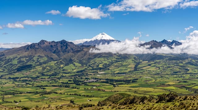
The Ilinizas are twin volcanic peaks split by erosion into two summits about a kilometre apart: Iliniza Norte at 5,126 metres, a scramble on rock and scree that experienced walkers do without technical gear, and Iliniza Sur at 5,248, glaciated and requiring rope, ice axe and a guide. Both are reached from El Chaupi, with a rough track to La Virgen and then a walk up to the Nuevos Horizontes refuge at about 4,700 metres, where climbers overnight before an early start. The wider reserve stretches west into cloud forest and includes the Quilotoa crater within its boundaries. The paramo approach is open, cold and often in cloud, with condors sometimes overhead.
The landscape
- Two summits from one volcano - a walk-up and a technical climb side by side.
- The refuge at 4,700 metres - the base for both peaks.
- Open paramo approach - the walk in from La Virgen.
- Quilotoa inside the reserve - the crater lake within the same boundary.
When to go
June to September for the driest window. Two days with a refuge night. Iliniza Norte still involves exposed scrambling; Sur needs a guide and glacier equipment.
Practical notes
Iliniza Norte is often underestimated: it has loose rock, exposure and real altitude, and people get into trouble on it. Sur is a serious mountaineering objective with retreating, broken ice. The refuge is basic and cold.
Nearby
Machachi is north-east; Quilotoa lies west in the same reserve.
Key facts
Source: Wikidata, item Q4744540, read on 18 October 2026.
What to pack for Los Ilinizas Ecological Reserve
Chosen from what this place is for. Tap a kit for the full checklist.
- Broken-in walking shoes or boots - Grip and ankle support matter more than looks; never hike in brand-new boots. Find on Amazon
- Binoculars - The single best wildlife tool - even a compact pair transforms a sighting. Find on Amazon
- Warm base layers - Merino or synthetic against the skin - never cotton, which chills when damp. Find on Amazon
- Layers for big temperature swings - Warm sun by day, near-freezing at night, even near the equator. Find on Amazon
Some links on this page are Amazon affiliate links - if you buy through them we may earn a small commission at no extra cost to you.
All packing kitsPlan your trip
Where to start if Los Ilinizas Ecological Reserve is going on the list.
Booking links on this page are affiliate links - if you book through them we may earn a small commission at no extra cost to you. It never changes what we write about a place.
Opening times, ticket prices and seasonal closures change - check the official source before you go: official site.