Alejandro de Humboldt National Park
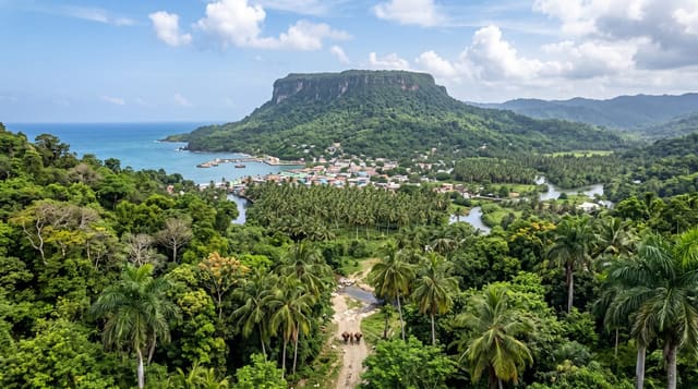
Mountain rainforest above Baracoa on serpentine rock, with a rate of endemism among the highest of any island on earth.
Updated 18 October 2026
UNESCO World Heritage
Humboldt covers the wettest and most rugged corner of eastern Cuba, and it was inscribed on the World Heritage list in 2001 for the extraordinary concentration of species found nowhere else. The reason is the rock: serpentine and other toxic-metal soils that most plants cannot tolerate, which forced repeated adaptation and produced a flora that is largely endemic. It is also the last place the Cuban ivory-billed woodpecker was reliably reported, and where the almiquí, a rare insectivore, survives.
History
People have made little use of this land: only one pre-Columbian archaeological site is known, on the coast at Aguas Verdes, and in the 18th and 19th centuries escaped slaves used some outlying places as refuges. The park took shape from the 1960s with the Jaguaní and Cupeyal del Norte reserves and, in the 1980s, the proposed Ojito del Agua refuge, linked to the last sighting of the Cuban ivory-billed woodpecker; in 1996 these areas were joined into a national park named after Alexander von Humboldt, who visited Cuba in 1800 and 1801, and in 2001 it was declared a World Heritage Site for its size, range of altitude, complex geology and wealth of endemic plants and animals (Wikipedia, Alejandro de Humboldt National Park).
What you'll find
- The endemic flora - plants adapted to serpentine soils, with an endemism rate among the world's highest for an island.
- The Cuban parrot and tody - among the birds regularly seen on the trails.
- The Taco Bay trails - guided walks from the park entrance through forest and up to viewpoints.
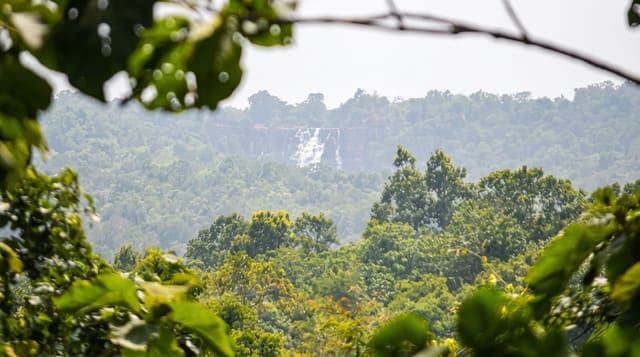
- The rivers - clear streams cutting down through the forest to the bay.
When to go
November to April is the drier season, which matters here because this is the wettest region in Cuba. Even then rain is likely most days. Birding is best at first light, which means arranging an early start with the park.
What to expect
Guides are compulsory and the trails cannot be walked alone; this is enforced. The famous woodpecker has not been confirmed for decades and is very probably gone, whatever guides may hint. Trails are steep, muddy and hot, and the almiquí is nocturnal and effectively never seen.
Nearby
Baracoa is an hour southeast, and the Yumuri river mouth is on the road between them.
Key facts
Source: Wikidata, item Q48153, read on 18 October 2026.
What to pack for Alejandro de Humboldt National Park
Chosen from what this place is for. Tap a kit for the full checklist.
- Broken-in walking shoes or boots - Grip and ankle support matter more than looks; never hike in brand-new boots. Find on Amazon
- Binoculars - The single best wildlife tool - even a compact pair transforms a sighting. Find on Amazon
- Strong insect repellent - DEET or picaridin; the jungle is where bites and disease risk are highest. Find on Amazon
- Layers + a waterproof shell - Mountain weather turns fast; a packable rain jacket saves the day. Find on Amazon
Some links on this page are Amazon affiliate links - if you buy through them we may earn a small commission at no extra cost to you.
All packing kitsPlan your trip
Where to start if Alejandro de Humboldt National Park is going on the list.
Booking links on this page are affiliate links - if you book through them we may earn a small commission at no extra cost to you. It never changes what we write about a place.
Opening times, ticket prices and seasonal closures change - check the official source before you go: official site.