Pingjiang Road
A canal-side lane in Suzhou following a street plan drawn on a stone map in 1229, with teahouses and pingtan singing.
Updated 4 September 2026
AI illustration
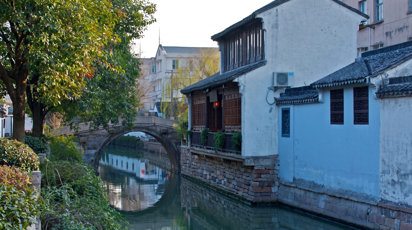
Pingjiang Road runs about a kilometre and a half along a canal in Suzhou's old town, and its layout can be checked against the Pingjiang Map, a city plan carved in stone in 1229 that shows the same street and waterway pattern still in place today, one of the oldest surviving urban maps in the world. Whitewashed houses with black tiled roofs line the water, crossed by small stone bridges, with teahouses, craft shops, silk sellers and small museums along the lane and residents still living in the side alleys. Pingtan, the Suzhou storytelling and ballad form sung to a three-stringed lute, is performed in teahouses along the street.
What's there
- The 1229 street plan - a layout matching a stone map drawn eight centuries ago.
- The canal and bridges - water, whitewashed houses and small stone crossings.
- The pingtan teahouses - Suzhou ballad singing performed to a small audience.
- The side alleys - residential lanes still lived in behind the main street.
When to go
March to May and September to November; the street is busiest at weekends and in holidays. Early morning and evening are quieter and better lit for photographs. Summer humidity in Suzhou is heavy.
Before you go
The main lane is commercialised with chain tea and snack shops. Crowds at weekends are heavy in a narrow street. Pingtan performances are short and in Suzhou dialect, with no translation.
Nearby
The Humble Administrator's Garden lies north; Suzhou Museum is beside it.
Key facts
Source: Wikidata, item Q10281548, read on 18 October 2026.
What to pack for Pingjiang Road
Chosen from what this place is for. Tap a kit for the full checklist.
- Strong insect repellent - DEET or picaridin; the jungle is where bites and disease risk are highest. Find on Amazon
- Comfortable walking shoes - Sightseeing means kilometres of pavement and cobbles daily. Find on Amazon
- Long, light, quick-dry clothing - Covers skin from insects and sun without cooking you in the humidity. Find on Amazon
- A slim anti-theft daypack - Zips that close properly; keep it in front in crowds and on transit. Find on Amazon
Some links on this page are Amazon affiliate links - if you buy through them we may earn a small commission at no extra cost to you.
All packing kitsPlan your trip
Where to start if Pingjiang Road is going on the list.
Booking links on this page are affiliate links - if you book through them we may earn a small commission at no extra cost to you. It never changes what we write about a place.
Opening times, ticket prices and seasonal closures change - check the official source before you go: official site.