Isluga Volcano National Park
Aymara villages and a smoking volcano on the Bolivian border, with a geyser field on the way in.
Updated 30 August 2026
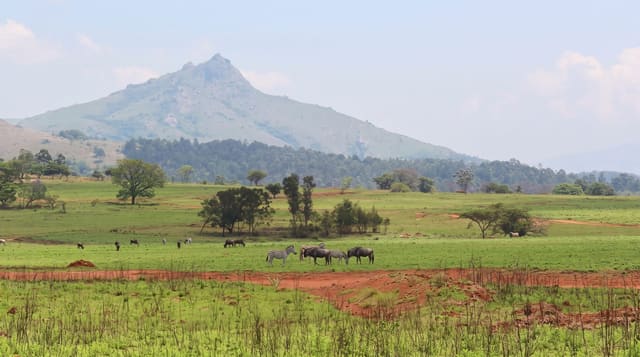
The park covers about 175,000 hectares of altiplano around Isluga volcano, a 5,550 metre cone with persistent fumarole activity at the summit. Inside it are Aymara villages - Isluga with its white church, Enquelga and others - which are largely empty most of the year because families live lower down and return for festivals and for herding seasons, a pattern of seasonal occupation that is normal in the high Andes. Bofedales, the high wetland pastures, support llama and alpaca herds along with vicuña. The Puchuldiza geyser field is on the route in, and hot springs at Enquelga are used by residents.
What you'll find
- Isluga at 5,550 metres - with persistent fumarole activity.
- Aymara villages - occupied seasonally for festivals and herding.
- Bofedal wetlands - the pastures the herds depend on.
- Puchuldiza geysers - on the road in.
When to go
April to November; the summer rains close the tracks. A full day or more.
Good to know
Everything here is above 3,600 metres and altitude sickness is common. There are no services in the park and few in Colchane. Roads are rough. Villages are people's homes and are quiet by design, not abandoned.
Nearby
Colchane and the Bolivian border are east; Salar de Surire is north.
Key facts
Source: Wikidata, item Q1702875, read on 18 October 2026.
What to pack for Isluga Volcano National Park
Chosen from what this place is for. Tap a kit for the full checklist.
- Broken-in walking shoes or boots - Grip and ankle support matter more than looks; never hike in brand-new boots. Find on Amazon
- Binoculars - The single best wildlife tool - even a compact pair transforms a sighting. Find on Amazon
- Layers for big temperature swings - Warm sun by day, near-freezing at night, even near the equator. Find on Amazon
- Swimwear - Needed at most public thermal pools; some traditional baths are nude and single-sex. Find on Amazon
Some links on this page are Amazon affiliate links - if you buy through them we may earn a small commission at no extra cost to you.
All packing kitsPlan your trip
Where to start if Isluga Volcano National Park is going on the list.
Booking links on this page are affiliate links - if you book through them we may earn a small commission at no extra cost to you. It never changes what we write about a place.
Opening times, ticket prices and seasonal closures change - check the official source before you go: official site.