Chiloe National Park
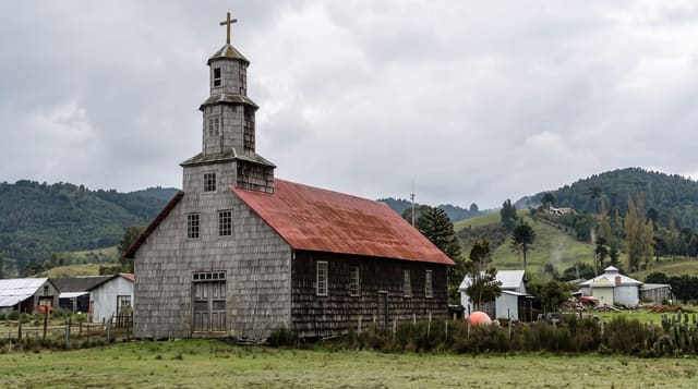
Wet coastal forest and dunes on Chiloe's Pacific side, home to a rare fox that lives mostly on this island.
Updated 21 October 2026
The park runs along the western coast of Chiloe, where the island faces the open Pacific: dunes, long beaches, peat bogs and dense evergreen forest of tepu, coigue and arrayan, in one of the wettest climates in Chile. It protects Darwin's fox, an endangered species that lives mostly on Chiloe, with smaller populations on the mainland, along with pudu and a large number of birds. Trails run from Cucao through the dunes and into the forest, including a boardwalk over the bog. The Huilliche communities living around the park are involved in its management, and some sectors are on their land.
History
The park was created by Supreme Decree No. 734 in 1982, in two main sectors: the smaller Chepu in the commune of Ancud and the larger Anay in the communes of Dalcahue, Castro and Chonchi, with the islet of Metalqui besides. Since then its area has shrunk by more than 45 km², as land with settlements that was first drawn inside the protected area was taken out (Wikipedia, Chiloé National Park).
What you'll find
- Dunes and Pacific beaches - on Chiloe's exposed western side.
- Dense evergreen forest - tepu, coigue and arrayan on peat.
- Darwin's fox - most of the species lives on Chiloe.
- Huilliche involvement - communities managing parts of the park.
When to go
December to March. A full day.
Before you go
It rains here on most days of most months and the trails are boardwalk and mud. The Pacific here is cold and dangerous - swimming is not sensible. Facilities are camping and a visitor centre. Roads in are gravel.
Nearby
Cucao is at the gate; the Muelle de las Almas is south along the coast.
Key facts
Source: Wikidata, item Q1702892, read on 18 October 2026.
What to pack for Chiloe National Park
Chosen from what this place is for. Tap a kit for the full checklist.
- Broken-in walking shoes or boots - Grip and ankle support matter more than looks; never hike in brand-new boots. Find on Amazon
- Reef-safe sunscreen - High SPF that will not bleach the coral you are swimming over. Find on Amazon
- Binoculars - The single best wildlife tool - even a compact pair transforms a sighting. Find on Amazon
- Loose, light, long clothing - Covering up beats bare skin in the desert - and locals dress this way for a reason. Find on Amazon
Some links on this page are Amazon affiliate links - if you buy through them we may earn a small commission at no extra cost to you.
All packing kitsPlan your trip
Where to start if Chiloe National Park is going on the list.
Booking links on this page are affiliate links - if you book through them we may earn a small commission at no extra cost to you. It never changes what we write about a place.
Opening times, ticket prices and seasonal closures change - check the official source before you go: official site.