Itaparica Island
The large island facing Salvador across All Saints Bay, reached by ferry, with a fort, a spring and quiet beaches.
Updated 19 October 2026
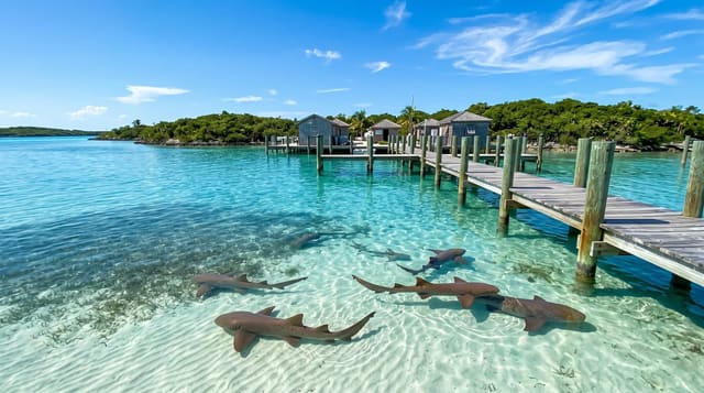
Itaparica is the largest island in All Saints Bay and the closest escape from Salvador, reached either by car ferry from Sao Joaquim or by the small passenger boat from the Mercado Modelo to Mar Grande. The town of Itaparica at the northern end has the Forte de Sao Lourenco, a colonial work that held out against Portuguese loyalist bombardment during the Bahian independence campaign of 1822-23, along with a matriz church and the Fonte da Bica, a spring the Portuguese bottled and shipped and which locals still fill bottles from. Beaches run down the bay side - Mar Grande, Penha, Barra Grande - calm and shallow, and mangrove covers much of the interior shoreline.
History
The island was home to many Tupinambá, and Amerigo Vespucci arrived on 1 November 1501; the first Portuguese settlement was the Jesuit outpost of Baiacu, founded in 1560 and later renamed Vera Cruz, where sugarcane and wheat were grown and the colony's first work of hydraulic engineering, a dam for drinking water, was built. Corsairs attacked it as early as 1597, and it later earned well for the Portuguese with a naval shipyard, lime kilns and whaling that lasted until the middle of the 19th century, while the first steam engine in Brazil was set up on its Ingá-Açu plantation (Wikipedia, Itaparica Island).
What to look for
- Forte de Sao Lourenco - the fort that held during the 1822 independence fight.
- The Fonte da Bica - a spring still used, once bottled and exported.
- Calm bay beaches - shallow water down the Salvador-facing shore.
- Two ferry routes - the car crossing and the small passenger boat.
When to go
September to March. A day.
Before you go
The car ferry queues for hours at weekends and holidays. The island is large and beaches are spread out, so a car or taxi is needed. Parts of the towns are run down. Bay water is calm but not always clean near the settlements.
Nearby
Salvador is across the bay; Cachoeira is inland at the head of the Reconcavo.
Key facts
Source: Wikidata, item Q2095391, read on 18 October 2026.
What to pack for Itaparica Island
Chosen from what this place is for. Tap a kit for the full checklist.
- Reef-safe sunscreen - High SPF that will not bleach the coral you are swimming over. Find on Amazon
- Quick-dry towel - A microfibre towel packs small and dries in minutes. Find on Amazon
- Water shoes - Protect your feet on rocky entries, hot sand and sea-urchin spines. Find on Amazon
- Dry bag - Keeps phone, cash and keys safe while you are in the water. Find on Amazon
Some links on this page are Amazon affiliate links - if you buy through them we may earn a small commission at no extra cost to you.
All packing kitsPlan your trip
Where to start if Itaparica Island is going on the list.
Booking links on this page are affiliate links - if you book through them we may earn a small commission at no extra cost to you. It never changes what we write about a place.
Opening times, ticket prices and seasonal closures change - check the official source before you go: official site.