Mingachevir
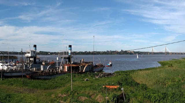
A city on the Kur below the country's largest reservoir, built for the dam and used now for rowing and water sport.
Updated 18 October 2026
Mingachevir was built in the late 1940s to house the workers on the hydroelectric dam that created the reservoir upstream, and the town still reads that way: wide streets, planned blocks and a river running through the middle of it. The reservoir behind the dam is the largest body of water in the country. The Kur below it is used as a rowing course and hosts national and international regattas, and the riverside is where the town spends its evenings.
History
Finds in the area run from the Eneolithic, around 3000 BC, to the 17th century AD; Adolf Berge of the Caucasus archaeological committee reported on its monuments in 1871, but serious digging began only in the 1930s with the hydroelectric project, when Professor Pakhomov found two ancient settlements and cemeteries in 1935. When work on the dam resumed, archaeologists led by S. M. Qaziyev excavated here from April 1946 to August 1953, and the present city was founded in 1948 for the power station on the Kura (Wikipedia, Mingachevir).
Highlights
- The reservoir - the country's largest, held back by the dam above the town.
- The rowing course - a stretch of the Kur used for regattas and training.
- The riverside - promenades and cafés along both banks in the centre.
- The planned town - post-war blocks and boulevards built for the dam workforce.
When to go
April to October is the comfortable season; summer on the Kur plain is very hot. Regattas are held through spring and autumn. Winter is grey and the riverside empties.
Before you go
There is little conventional sightseeing here and the town is a working one. Access to the dam itself is restricted. The reservoir shore is largely undeveloped and not easy to reach without a car.
Nearby
Ganja is an hour and a half west, and the Barda mausoleum is south across the plain.
Key facts
Source: Wikidata, item Q230932, read on 18 October 2026.
What to pack for Mingachevir
Chosen from what this place is for. Tap a kit for the full checklist.
- Broken-in walking shoes or boots - Grip and ankle support matter more than looks; never hike in brand-new boots. Find on Amazon
- Layers + a waterproof shell - Mountain weather turns fast; a packable rain jacket saves the day. Find on Amazon
- Daypack with rain cover - 20-30 litres holds water, snacks, layers and a first-aid kit. Find on Amazon
- Offline maps + a power bank - Download the trail before you lose signal; carry backup charge. Find on Amazon
Some links on this page are Amazon affiliate links - if you buy through them we may earn a small commission at no extra cost to you.
All packing kitsPlan your trip
Where to start if Mingachevir is going on the list.
Booking links on this page are affiliate links - if you book through them we may earn a small commission at no extra cost to you. It never changes what we write about a place.
Opening times, ticket prices and seasonal closures change - check the official source before you go: official site.