Obernberger See
A lake near the Brenner split in two by an old rockslide, with a chapel standing on the debris.
Updated 21 October 2026
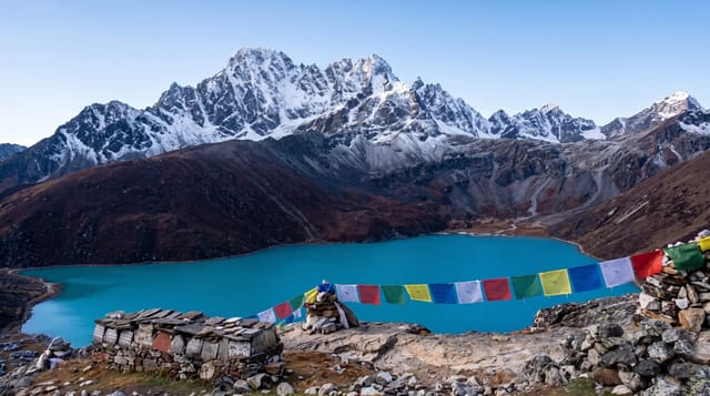
The Obernberger See lies at about sixteen hundred metres at the head of the Obernbergtal, a side valley off the Brenner, and a prehistoric rockslide from the Obernberger Tribulaun splits it into two parts that join only at high water; the level swings by up to seven metres between the winter low and the snowmelt high. A small chapel, the Kapelle Maria am See, stands on the rockslide debris between the two parts, reached by a bridge when the water is high, and is the standard photograph. The setting is quiet - the lake has been a natural monument since 1935, there is no road to the lake itself, and reaching it means about forty-five minutes on foot or a shuttle from the village. Routes continue over the Portjoch into Italy, a crossing used for centuries.
What's there
- Two lakes in one - divided by rockslide debris, joined at high water.
- The lakeside chapel - Maria am See on the debris between the two parts.
- A protected lake - a natural monument since 1935, with no road to the shore.
- The Portjoch crossing - the old route on over into Italy.
When to go
June to October. Half a day.
Good to know
The last stretch is on foot - about forty-five minutes from the village car park. The lake is shallow and cold. Snow lies late in the valley. Facilities are one hut.
Nearby
The Brenner pass is east; Steinach and the Gschnitztal are north.
Key facts
Source: Wikidata, item Q877038, read on 18 October 2026.
What to pack for Obernberger See
Chosen from what this place is for. Tap a kit for the full checklist.
- Reef-safe sunscreen - High SPF that will not bleach the coral you are swimming over. Find on Amazon
- Warm base layers - Merino or synthetic against the skin - never cotton, which chills when damp. Find on Amazon
- Shelter suited to the place - Tent, tarp or hut booking - match it to the terrain and rules. Find on Amazon
- Quick-dry towel - A microfibre towel packs small and dries in minutes. Find on Amazon
Some links on this page are Amazon affiliate links - if you buy through them we may earn a small commission at no extra cost to you.
All packing kitsPlan your trip
Where to start if Obernberger See is going on the list.
Booking links on this page are affiliate links - if you book through them we may earn a small commission at no extra cost to you. It never changes what we write about a place.
Opening times, ticket prices and seasonal closures change - check the official source before you go: official site.