Hinchinbrook Island
Australia's largest island national park, a mountain wilderness crossed by the four-day Thorsborne Trail.
Updated 18 October 2026
AI illustration
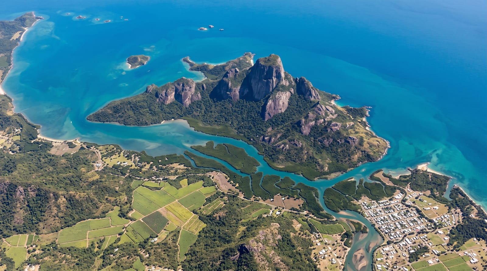
Hinchinbrook is separated from the mainland by a narrow mangrove channel and rises to more than a thousand metres at Mount Bowen, an island of rainforest, granite peaks, mangrove creeks and empty beaches that is entirely national park with no resort, shop or road. The Thorsborne Trail runs thirty-two kilometres down its eastern side over three to four days, crossing creeks, climbing headlands and passing beaches and waterfalls, with numbers capped at forty walkers at a time to limit impact, which means permits are booked months ahead. Estuarine crocodiles inhabit the creeks and mangroves, and walkers must store food against native rats.
History
The island, Pouandai to the Biyaygiri people who first lived on it, keeps their shell middens and the Bandjin fish traps, rock walls that use the tides to catch fish and still trap them today. James Cook sailed past at a distance in 1770 and named Point Hillock, Phillip Parker King suspected in 1819 that it was an island but could not confirm it, and only in 1843, when Captain Blackwood of HMS Fly spent two weeks in the area, did the British establish that it was separate from the mainland (Wikipedia, Hinchinbrook Island).
What you'll find
- The Thorsborne Trail - a capped-number wilderness walk down the east coast.
- Mount Bowen - the granite peak rising above rainforest.
- The mangrove channel - the narrow waterway separating island from mainland.
- The empty beaches - Ramsay Bay, Zoe Bay and Mulligan Falls along the route.
When to go
April to September, the dry season; the wet from December to March brings heavy rain, flooded creeks and heat. Permits are limited to forty walkers and book out months in advance. Boat transfers depend on tide and weather.
What to expect
There are no facilities of any kind: all food, water treatment and gear must be carried, and rubbish carried out. Estuarine crocodiles are present and creek crossings need care. Boat transfers are expensive and can be cancelled, leaving walkers stranded a day.
Nearby
Cardwell is the main departure point; Lucinda is at the southern end.
Key facts
Source: Wikidata, item Q2544036, read on 18 October 2026.
What to pack for Hinchinbrook Island
Chosen from what this place is for. Tap a kit for the full checklist.
- Broken-in walking shoes or boots - Grip and ankle support matter more than looks; never hike in brand-new boots. Find on Amazon
- Reef-safe sunscreen - High SPF that will not bleach the coral you are swimming over. Find on Amazon
- Strong insect repellent - DEET or picaridin; the jungle is where bites and disease risk are highest. Find on Amazon
- Layers + a waterproof shell - Mountain weather turns fast; a packable rain jacket saves the day. Find on Amazon
Some links on this page are Amazon affiliate links - if you buy through them we may earn a small commission at no extra cost to you.
All packing kitsPlan your trip
Where to start if Hinchinbrook Island is going on the list.
Booking links on this page are affiliate links - if you book through them we may earn a small commission at no extra cost to you. It never changes what we write about a place.
Opening times, ticket prices and seasonal closures change - check the official source before you go: official site.