Girraween National Park
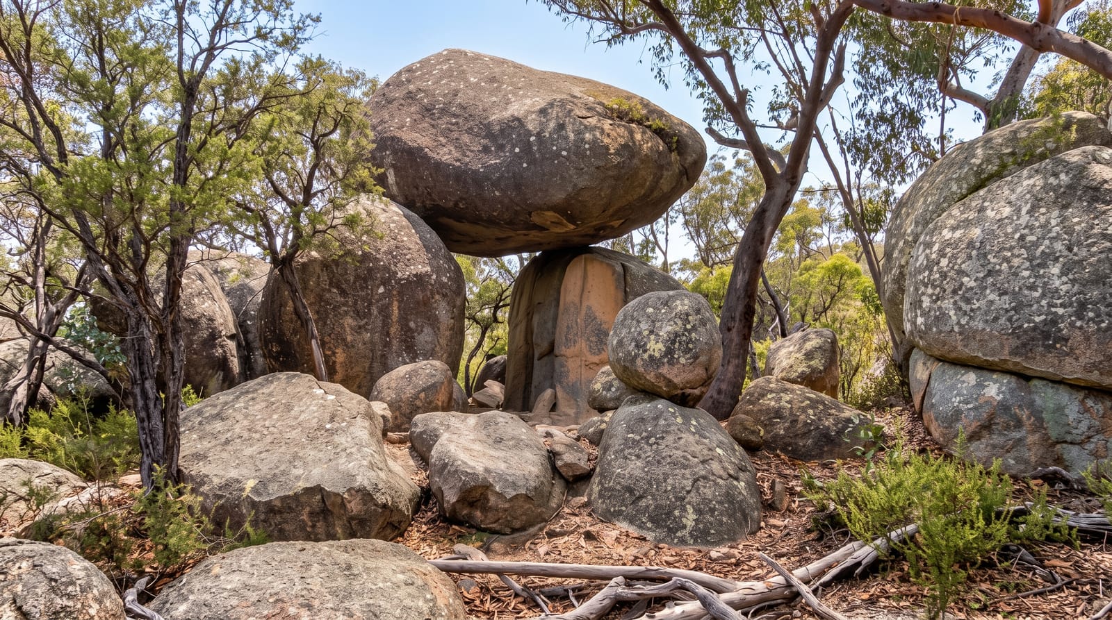
Granite domes, balancing boulders and spring wildflowers on the Queensland side of the Granite Belt.
Updated 18 October 2026
AI illustration
Girraween, meaning place of flowers, sits at around a thousand metres on the Granite Belt where Queensland meets New South Wales, in country of weathered granite: smooth domes, tors and boulders left balancing on one another as the softer rock around them eroded away. The Pyramid, a bare granite dome climbed on a steep slab, is the signature walk, along with Castle Rock, Bald Rock Creek and the Granite Arch. In spring the heath and woodland flower heavily with wattles, boronias and orchids, which gave the park its name. Winters are cold enough for frost and occasional snow, unusual for Queensland, and the granite holds pools that make good swimming in summer.
History
Aboriginal people have lived in the area for thousands of years, using its granite for shelter and ceremony, and the name is an Aboriginal word for place of flowers. Settlers came from the middle of the 19th century for grazing and later for the tin of the Granite Belt, though the rugged granite and remoteness kept settlement light, and the national park was established on 21 October 1966 (Wikipedia, Girraween National Park).
What you'll find
- The Pyramid - a bare granite dome climbed up a steep open slab.
- The balancing boulders - granite tors perched on one another across the park.
- The spring wildflowers - heavy flowering from August through November.
- The granite pools - creek pools among the rock for summer swimming.
When to go
August to November for wildflowers and comfortable walking; winter brings frost and rare snow, and summer is warm with storms. The Pyramid climb is best early before the slab heats. Camping books out in school holidays.
Practical notes
The Pyramid slab is steep and exposed, and wet or windy conditions make it dangerous. There is no water on the walks. Nights at altitude are much colder than visitors expect in Queensland, dropping below zero in winter.
Nearby
Stanthorpe and the Granite Belt wineries lie north; Bald Rock is across the border.
Key facts
Source: Wikidata, item Q165026, read on 18 October 2026.
What to pack for Girraween National Park
Chosen from what this place is for. Tap a kit for the full checklist.
- Broken-in walking shoes or boots - Grip and ankle support matter more than looks; never hike in brand-new boots. Find on Amazon
- Reef-safe sunscreen - High SPF that will not bleach the coral you are swimming over. Find on Amazon
- Binoculars - The single best wildlife tool - even a compact pair transforms a sighting. Find on Amazon
- Warm base layers - Merino or synthetic against the skin - never cotton, which chills when damp. Find on Amazon
Some links on this page are Amazon affiliate links - if you buy through them we may earn a small commission at no extra cost to you.
All packing kitsPlan your trip
Where to start if Girraween National Park is going on the list.
Booking links on this page are affiliate links - if you book through them we may earn a small commission at no extra cost to you. It never changes what we write about a place.
Opening times, ticket prices and seasonal closures change - check the official source before you go: official site.