Gawler Ranges National Park
Volcanic hills 1,500 million years old, with cliffs of hexagonal rhyolite columns known as the Organ Pipes.
Updated 18 October 2026

AI illustration
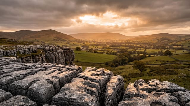
The Gawler Ranges are the eroded remains of volcanic activity around 1,500 million years ago, among the oldest volcanic landscapes on earth, worn down into rounded red hills of rhyolite above saltbush plains. The Organ Pipes, the park's landmark, are a cliff of hexagonal columns formed as thick lava cooled and cracked, similar in origin to basalt columns elsewhere but in a much older and different rock. Waterholes at Kolay Mirica and Pondanna hold water after rain and draw wildlife, and the park supports yellow-footed rock-wallabies, emus, red kangaroos and, in spring, wildflower displays across the plains. Tracks are unsealed and there are no services inside.
History
The national park began as the Paney Station pastoral lease of 1,200 square kilometres, bought in 2000 by the South Australian government with help from the federal government, and in 2001 some 420 square kilometres of the neighbouring Scrubby Peak Station were added to it (Wikipedia, Gawler Ranges National Park).
Highlights
- The Organ Pipes - a cliff of hexagonal rhyolite columns.
- The volcanic hills - rounded red ranges from 1,500 million years ago.
- The rock-wallabies - yellow-footed rock-wallabies among the boulders.
- The spring wildflowers - flowering across the plains after winter rain.
When to go
April to October; summer is extremely hot with no shade. Wildflowers follow good winter rain, usually August to October. Roads become impassable after rain and are closed, sometimes for days.
Practical notes
All roads inside the park are unsealed and rough, and high clearance is strongly advised. There is no water, fuel or phone coverage. Campsites are basic. The nearest supplies are at Wudinna or Kimba, a long drive away.
Nearby
Wudinna and the Eyre Highway lie south; Lake Gairdner is north.
Key facts
Source: Wikidata, item Q1496499, read on 18 October 2026.
What to pack for Gawler Ranges National Park
Chosen from what this place is for. Tap a kit for the full checklist.
- Broken-in walking shoes or boots - Grip and ankle support matter more than looks; never hike in brand-new boots. Find on Amazon
- Binoculars - The single best wildlife tool - even a compact pair transforms a sighting. Find on Amazon
- Shelter suited to the place - Tent, tarp or hut booking - match it to the terrain and rules. Find on Amazon
- Layers + a waterproof shell - Mountain weather turns fast; a packable rain jacket saves the day. Find on Amazon
Some links on this page are Amazon affiliate links - if you buy through them we may earn a small commission at no extra cost to you.
All packing kitsPlan your trip
Where to start if Gawler Ranges National Park is going on the list.
Booking links on this page are affiliate links - if you book through them we may earn a small commission at no extra cost to you. It never changes what we write about a place.
Opening times, ticket prices and seasonal closures change - check the official source before you go: official site.