Eungella National Park
Cloud forest above the Pioneer Valley where platypus are seen from a viewing platform more reliably than almost anywhere.
Updated 18 October 2026

AI illustration
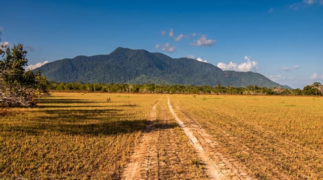
Eungella, meaning land of cloud, sits on a range above the Pioneer Valley west of Mackay, where subtropical rainforest has been isolated from other rainforest blocks for long enough to produce endemic species, including the Eungella honeyeater and the Eungella day frog. Its main draw is at Broken River, where a viewing platform overlooks pools in which platypus feed morning and evening; sightings here are more reliable than at almost any other accessible site in Australia, and rangers keep records of activity. Walking tracks follow the river and climb through the forest, and the road up from Finch Hatton is one of the steepest sealed public roads in Queensland.
History
The Wirri people are the original inhabitants, and the name Eungella is an Aboriginal word for land of cloud. The national park was declared over 49,610 hectares in 1941 and extended in 1986 to take in land at Mount Beatrice and former state forest near Finch Hatton, bringing it to about 52,900 hectares (Wikipedia, Eungella National Park).
What's there
- The platypus pools - the Broken River platform with regular sightings.
- The cloud forest - isolated rainforest with species found nowhere else.
- The river walks - tracks along Broken River through the forest.
- The range road - the very steep climb from the Pioneer Valley.
When to go
April to October for the driest weather; platypus are most active at dawn and dusk in any season, and viewing is quietest early. Summer brings heavy rain and leeches. Winter mornings on the range are cold and misty.
Good to know
The range road is extremely steep, with a very tight ascent unsuitable for large caravans. Platypus require patience, silence and stillness; noise and movement send them under. Facilities are limited to a campground, kiosk and small village.
Nearby
Finch Hatton Gorge is on the way up; Mackay lies east on the coast.
Key facts
Source: Wikidata, item Q1333457, read on 18 October 2026.
What to pack for Eungella National Park
Chosen from what this place is for. Tap a kit for the full checklist.
- Broken-in walking shoes or boots - Grip and ankle support matter more than looks; never hike in brand-new boots. Find on Amazon
- Binoculars - The single best wildlife tool - even a compact pair transforms a sighting. Find on Amazon
- Strong insect repellent - DEET or picaridin; the jungle is where bites and disease risk are highest. Find on Amazon
- Layers + a waterproof shell - Mountain weather turns fast; a packable rain jacket saves the day. Find on Amazon
Some links on this page are Amazon affiliate links - if you buy through them we may earn a small commission at no extra cost to you.
All packing kitsPlan your trip
Where to start if Eungella National Park is going on the list.
Booking links on this page are affiliate links - if you book through them we may earn a small commission at no extra cost to you. It never changes what we write about a place.
Opening times, ticket prices and seasonal closures change - check the official source before you go: official site.