Laguna del Diamante
A cold lagoon at 3,300 metres that mirrors the Maipo volcano's perfect cone, open for only a few months a year.
Updated 4 September 2026

AI illustration
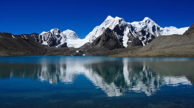
Laguna del Diamante lies at around 3,300 metres in a reserve on the Chilean border, a lake of meltwater fed by snow from the surrounding cordillera, and when the wind drops it reflects the Maipo volcano, a near-symmetrical cone of about 5,300 metres rising directly beyond the far shore. Legend has it the lake's name comes from that reflection, described as a diamond in early accounts. The road in climbs through the Portillo valley, past the Refugio Militar and over a high pass, and the reserve protects guanacos, condors and high-altitude wetland. San Martín's army crossed the Andes through this area in 1817, and the route is marked in places.
The landscape
- The volcano reflection - Maipo's cone mirrored in still water.
- The high lagoon - cold meltwater at over three thousand metres.
- The wildlife - guanacos, condors and waterbirds on the wetlands.
- The mountain road - the climb through the Portillo valley and over the pass.
When to go
December to March only; the reserve opens for a short summer window and snow closes the road the rest of the year, with exact dates varying each season. Wind rises through the day, so the mirror effect is a morning phenomenon.
Before you go
The drive is around four hours each way on rough gravel with steep sections, and low cars struggle. Altitude affects many visitors. There is no fuel, food or signal beyond the control post, camping is basic, and wind at the lake is often brutal by afternoon.
Nearby
Mendoza city is the departure point; the Maipo volcano stands on the border beyond the lake.
Key facts
Source: Wikidata, item Q3175759, read on 18 October 2026.
What to pack for Laguna del Diamante
Chosen from what this place is for. Tap a kit for the full checklist.
- Broken-in walking shoes or boots - Grip and ankle support matter more than looks; never hike in brand-new boots. Find on Amazon
- Reef-safe sunscreen - High SPF that will not bleach the coral you are swimming over. Find on Amazon
- Binoculars - The single best wildlife tool - even a compact pair transforms a sighting. Find on Amazon
- Warm base layers - Merino or synthetic against the skin - never cotton, which chills when damp. Find on Amazon
Some links on this page are Amazon affiliate links - if you buy through them we may earn a small commission at no extra cost to you.
All packing kitsPlan your trip
Where to start if Laguna del Diamante is going on the list.
Booking links on this page are affiliate links - if you book through them we may earn a small commission at no extra cost to you. It never changes what we write about a place.
Opening times, ticket prices and seasonal closures change - check the official source before you go: official site.