Lago Huechulafquen
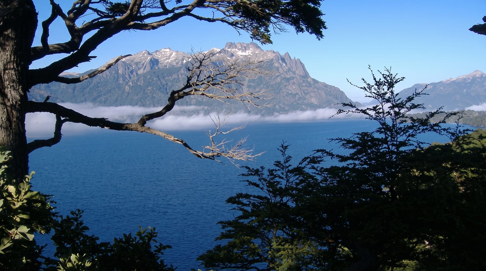
The largest lake in Lanín national park, a long blue sheet of water lying directly beneath the volcano's snow cone.
Updated 4 September 2026
AI illustration
Huechulafquen stretches some thirty kilometres west from the steppe into the mountains, and the view along it is the classic image of Lanín national park: dark water, black volcanic beaches, southern beech forest on the slopes and the white cone of Lanín closing the horizon. The gravel road along the north shore passes campsites, Mapuche-run hosterías and the lava flows of Puerto Canoa, ending near where Huechulafquen joins the narrower Lago Paimún. Trails lead from the road to the base of the volcano, to the Cascada El Saltillo waterfall and up to viewpoints on El Chivo. Fishing is excellent for trout and landlocked salmon, and boats run trips on the lake in summer.
What you'll find
- The volcano view - Lanín's snow cone rising at the head of the lake.
- The black beaches - volcanic sand and stone along the shore.
- The forest trails - walks to El Saltillo waterfall and viewpoints.
- The Mapuche campsites - community-run camping and food along the shore.
When to go
December to March, when the road is open and campsites operate; the lake is cold for swimming even in midsummer. Autumn is beautiful and quiet. Winter snow closes much of the access.
What to expect
The shore road is gravel, dusty and slow, and hard on low cars. Facilities are simple, with limited shops, so supplies should come from Junín. Wind off the lake is frequent and strong, and afternoons are often gusty.
Nearby
Junín de los Andes is the base; Lago Paimún continues west toward the border.
Key facts
Source: Wikidata, item Q2421713, read on 18 October 2026.
What to pack for Lago Huechulafquen
Chosen from what this place is for. Tap a kit for the full checklist.
- Travel rod + reel - A packable multi-piece rod fits in a case and covers most holiday fishing. Find on Amazon
- Reef-safe sunscreen - High SPF that will not bleach the coral you are swimming over. Find on Amazon
- Warm base layers - Merino or synthetic against the skin - never cotton, which chills when damp. Find on Amazon
- Shelter suited to the place - Tent, tarp or hut booking - match it to the terrain and rules. Find on Amazon
Some links on this page are Amazon affiliate links - if you buy through them we may earn a small commission at no extra cost to you.
All packing kitsPlan your trip
Where to start if Lago Huechulafquen is going on the list.
Booking links on this page are affiliate links - if you book through them we may earn a small commission at no extra cost to you. It never changes what we write about a place.
Opening times, ticket prices and seasonal closures change - check the official source before you go: official site.