Iruya
A village of steep cobbled lanes clinging to a mountainside in a deep canyon, reached over a 4,000 metre pass on a spectacular gravel road.
Updated 18 October 2026
AI illustration
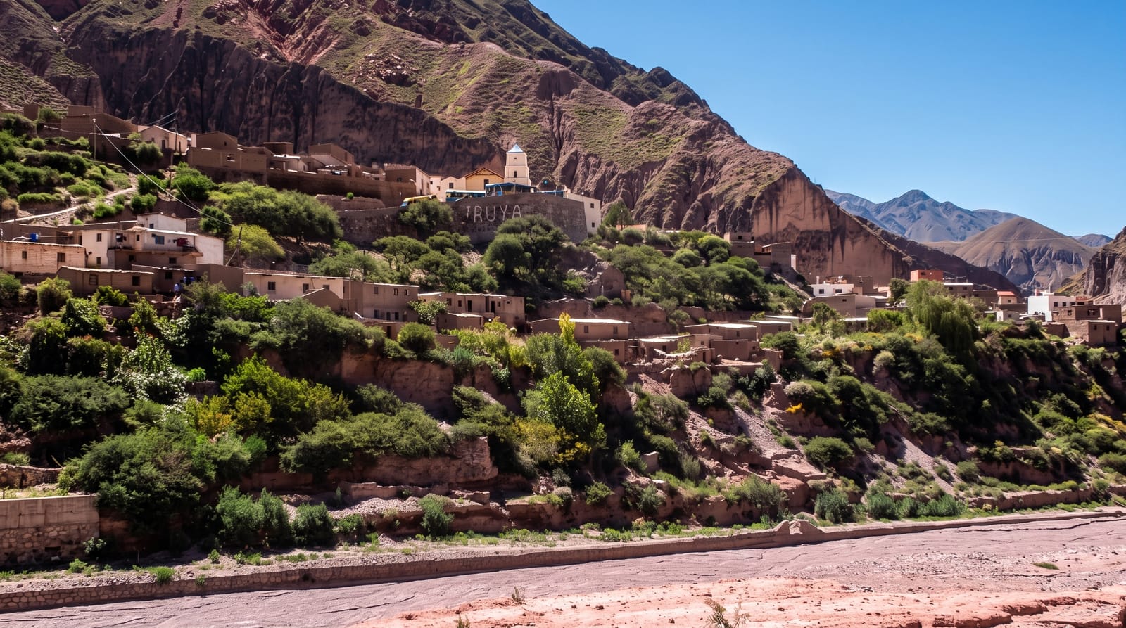
Iruya is built into the flank of a mountain above the confluence of two rivers in the far north of Salta province, its whitewashed houses stacked on slopes so steep that the streets are cobbled ramps and stairways, and its small church stands at the top like a beacon above the roofs. The way in is half the story: the road leaves the Quebrada de Humahuaca in Jujuy, climbs to the Abra del Cóndor at around 4,000 metres, then drops in long gravel switchbacks into a canyon system of extraordinary scale, with terraced fields on impossible gradients. The village keeps its Andean rhythms, with mule trains still used to reach outlying hamlets and an October festival that draws people from across the valleys. From Iruya walkers set out for San Isidro, a hamlet a few hours away on foot.
History
The first inhabitants settled here around a century before the town's official founding in 1753, mainly native people descended from the Ocloyas, a Kolla people from the Kollasuyo, one of the four regions of the Inca empire, and the church was built in 1690 (Wikipedia, Iruya).
What you'll find
- The stacked village - white houses and cobbled ramps clinging to the slope.
- The church above the roofs - the small white church at the top of the village.
- Abra del Cóndor - the 4,000 metre pass on the road in, with immense views.
- The walk to San Isidro - the riverbed trail to a remote hamlet beyond.
When to go
April to November, the dry season; summer rains swell the rivers the road and trails cross, and access can be cut for days. The festival in early October is the village's liveliest moment. Nights are cold all year at 2,780 metres.
Practical notes
The road is gravel, narrow and slow, and the journey takes several hours each way from Humahuaca, so a day trip is punishing; staying overnight is far better. The village is steep enough to be hard work on foot. Accommodation and food are simple, and power cuts are routine.
Nearby
Humahuaca and the Quebrada lie back over the pass; Salta city is far to the south.
Key facts
Source: Wikidata, item Q1020428, read on 18 October 2026.
What to pack for Iruya
Chosen from what this place is for. Tap a kit for the full checklist.
- Broken-in walking shoes or boots - Grip and ankle support matter more than looks; never hike in brand-new boots. Find on Amazon
- Layers for big temperature swings - Warm sun by day, near-freezing at night, even near the equator. Find on Amazon
- Comfortable walking shoes - Sightseeing means kilometres of pavement and cobbles daily. Find on Amazon
- Shelter suited to the place - Tent, tarp or hut booking - match it to the terrain and rules. Find on Amazon
Some links on this page are Amazon affiliate links - if you buy through them we may earn a small commission at no extra cost to you.
All packing kitsPlan your trip
Where to start if Iruya is going on the list.
Booking links on this page are affiliate links - if you book through them we may earn a small commission at no extra cost to you. It never changes what we write about a place.
Opening times, ticket prices and seasonal closures change - check the official source before you go: official site.