Serranía de Hornocal
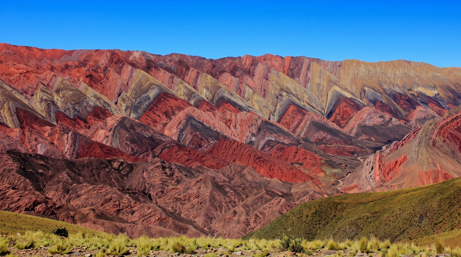
A jagged wall of rock above Humahuaca banded in fourteen colours, seen from a viewpoint at over 4,300 metres reached by a rough mountain road.
Updated 4 September 2026
AI illustration
The Serranía de Hornocal is a limestone and sandstone ridge east of Humahuaca whose flank has been folded into a great zigzag and stained in bands of pink, cream, ochre, green and violet, the mineral layers standing on end like teeth. Locals call it the Hill of Fourteen Colours, and it is a far larger and wilder spectacle than the famous seven-coloured hill at Purmamarca, though it takes real effort to reach. A rough gravel road climbs steeply out of Humahuaca to a viewpoint above 4,300 metres, where the whole serrated wall opens out across the valley, with the altiplano rolling away behind. The colours are at their most intense in the last hours of daylight, when low sun rakes across the folds and the ridge glows against a darkening sky.
The landscape
- The zigzag wall - the folded ridge banded in more than a dozen mineral colours.
- The viewpoint platform - the roadside mirador above 4,300 metres facing the ridge.
- The altiplano light - the vast high-plateau sky and long shadows at day's end.
- The road itself - the steep switchback climb from Humahuaca with valley views.
When to go
April to November, the dry season, when the gravel road is most reliable. Mid to late afternoon shows the colours best, though it means descending in the dark. Weather at this altitude turns quickly and cloud can hide the ridge entirely for hours.
What to expect
At over 4,300 metres altitude sickness is a genuine risk if you have not acclimatised in the valley first, and the cold and wind are severe even in summer. The road is unpaved, steep and unsuitable for low cars; most visitors hire a transfer. Cloud can cancel the view outright.
Nearby
Humahuaca sits below; Tilcara and the rest of the Quebrada lie south along the RN9.
Key facts
Source: Wikidata, item Q16630587, read on 18 October 2026.
What to pack for Serranía de Hornocal
Chosen from what this place is for. Tap a kit for the full checklist.
- Broken-in walking shoes or boots - Grip and ankle support matter more than looks; never hike in brand-new boots. Find on Amazon
- Spare batteries + cards - Cold and long shoots drain power; never run out at the good light. Find on Amazon
- Layers for big temperature swings - Warm sun by day, near-freezing at night, even near the equator. Find on Amazon
- Layers + a waterproof shell - Mountain weather turns fast; a packable rain jacket saves the day. Find on Amazon
Some links on this page are Amazon affiliate links - if you buy through them we may earn a small commission at no extra cost to you.
All packing kitsPlan your trip
Where to start if Serranía de Hornocal is going on the list.
Booking links on this page are affiliate links - if you book through them we may earn a small commission at no extra cost to you. It never changes what we write about a place.
Opening times, ticket prices and seasonal closures change - check the official source before you go: official site.