Captain's Bay
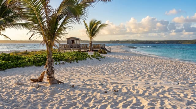
A remote beach at the island's northeastern end, reached on a rough track.
Updated 3 September 2026
Captain's Bay sits at Anguilla's northeastern end, a short beach between rocky points with the Atlantic coming in unbroken and nothing built anywhere near it. The track out is rough enough that most rental cars are not taken down it. The surf here is heavy and the undertow strong, so it is a place to walk and look rather than swim. Windward Point is a short way further on. The whole eastern end of the island is limestone scrub with almost no settlement, which is unusual for a Caribbean island of this size.
The landscape
- The unbroken Atlantic - swell arriving with no reef to stop it.
- The rocky points - the headlands enclosing the short beach.
- The isolation - the emptiest corner of the island.
- The rough track - the reason almost nobody comes.
When to go
December to April is the dry season. Swell on this coast is heaviest in the northern winter. Hurricane season runs June to November.
Before you go
Swimming here is dangerous because of the undertow and should not be attempted. The track needs high clearance. There is no shade and no facilities of any kind.
Nearby
Windward Point is northeast, and Island Harbour is west.
What to pack for Captain's Bay
Chosen from what this place is for. Tap a kit for the full checklist.
- Reef-safe sunscreen - High SPF that will not bleach the coral you are swimming over. Find on Amazon
- Quick-dry clothing - Board shorts or synthetics that shrug off spray and dry fast. Find on Amazon
- Quick-dry towel - A microfibre towel packs small and dries in minutes. Find on Amazon
- Secure water shoes or reef boots - Grip on slippery launches and protection on rocky shores. Find on Amazon
Some links on this page are Amazon affiliate links - if you buy through them we may earn a small commission at no extra cost to you.
All packing kitsPlan your trip
Where to start if Captain's Bay is going on the list.
Booking links on this page are affiliate links - if you book through them we may earn a small commission at no extra cost to you. It never changes what we write about a place.
Opening times, ticket prices and seasonal closures change - check the official source before you go: official site.