Djupalonssandur
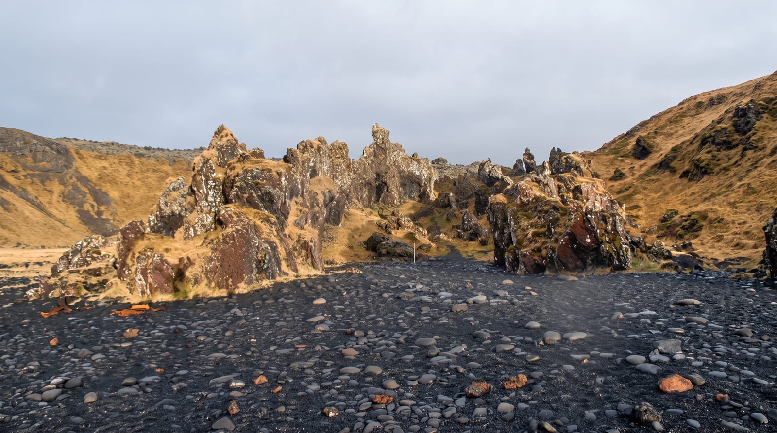
A cove of black rounded pebbles below lava crags, with four lifting stones and the scattered remains of a wrecked trawler.
Updated 21 October 2026
AI illustration
Djupalonssandur is a small bay on the south side of the Snaefellsnes tip, reached by a path that drops through eroded lava pinnacles to a beach of black pebbles polished round by the surf. Two things sit on the sand. One is a set of four lifting stones once used to test men for a place in fishing crews, ranging from a stone most people can shift to one of roughly 150 kilograms. The other is rusted wreckage from a British trawler that went aground here in 1948, left in place deliberately and protected, not to be moved. Behind the beach are freshwater pools and a rock arch.
History
Djúpalónssandur was once the site of a thriving fishing village, especially in the 18th and 19th centuries, and the nearby cove of Dritvík was one of Iceland's busiest fishing stations, with up to 60 boats at its height. Remains of the village and old fishing gear can still be found, along with the wreckage of the British trawler Epine GY7, which ran aground in 1948 (Wikipedia, Djúpalónssandur).
What's there
- The lifting stones - four graded boulders once used to test fishermen's strength.
- The trawler wreckage - rusted iron scattered on the sand, left in place and protected.
- The black pearls - the smooth rounded pebbles the beach is made of.
- The lava pinnacles - eroded rock forms flanking the path down into the cove.
When to go
Summer for the safest footing on the path and the best chance of calm sea. Mornings are quieter. Avoid the beach entirely in heavy swell, since waves here run up the shingle without warning and the shelf is steep. Winter visits are possible but the descent path ices over and is not gritted.
Practical notes
The path down is steep and uneven, and the climb back is harder than it looks. Waves are dangerous and there are no barriers or lifeguards. Removing pebbles or touching the wreckage is prohibited. The car park is small and fills quickly in the middle of the day.
Nearby
The rest of Snaefellsjokull National Park surrounds the bay, with Hellissandur to the north.
Key facts
Source: Wikidata, item Q5285420, read on 18 October 2026.
What to pack for Djupalonssandur
Chosen from what this place is for. Tap a kit for the full checklist.
- Travel rod + reel - A packable multi-piece rod fits in a case and covers most holiday fishing. Find on Amazon
- Reef-safe sunscreen - High SPF that will not bleach the coral you are swimming over. Find on Amazon
- Quick-dry clothing - Board shorts or synthetics that shrug off spray and dry fast. Find on Amazon
- A small tackle selection - Hooks, weights, line and a few lures or flies suited to local waters. Find on Amazon
Some links on this page are Amazon affiliate links - if you buy through them we may earn a small commission at no extra cost to you.
All packing kitsPlan your trip
Where to start if Djupalonssandur is going on the list.
Booking links on this page are affiliate links - if you book through them we may earn a small commission at no extra cost to you. It never changes what we write about a place.
Opening times, ticket prices and seasonal closures change - check the official source before you go: official site.