The Mount Alava Trail
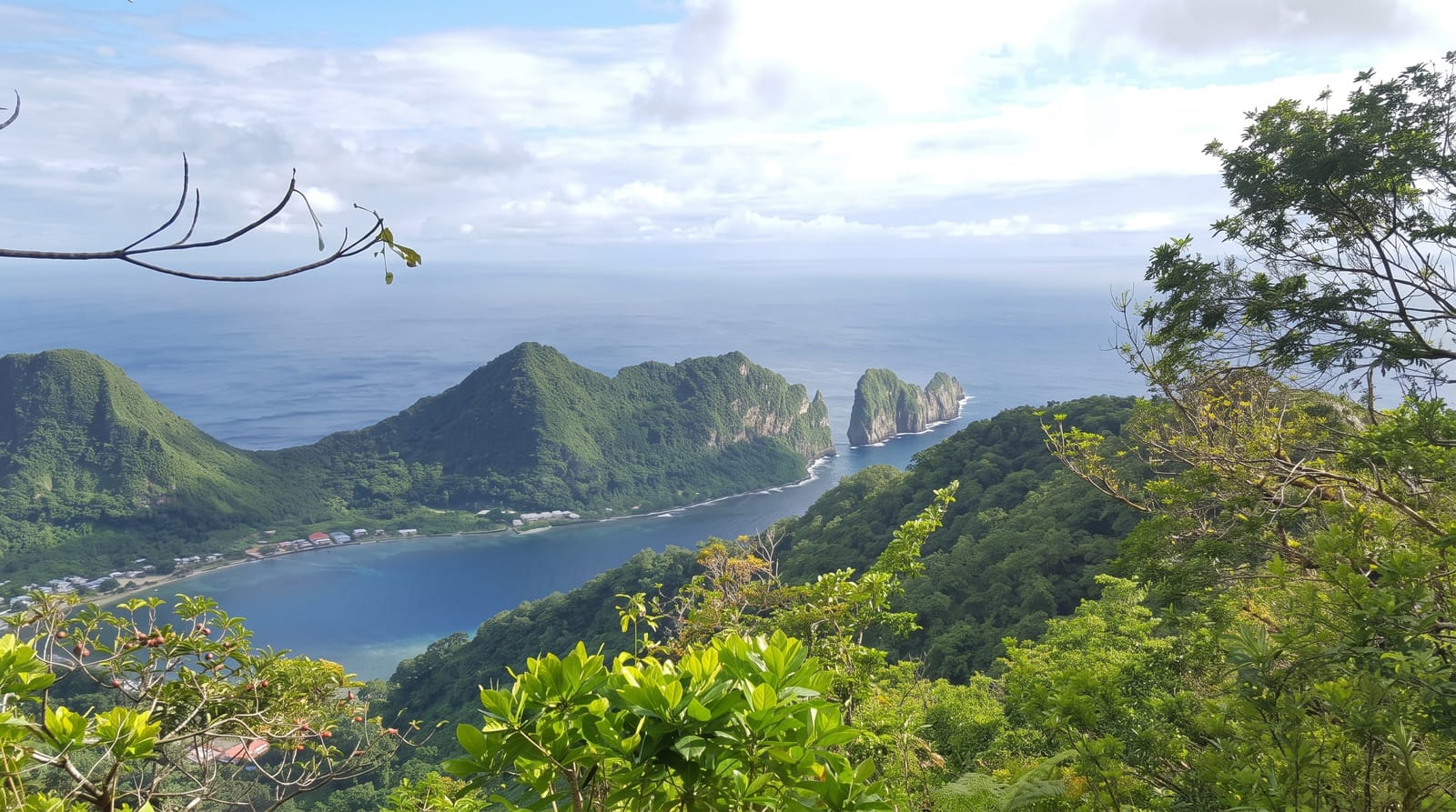
The ridge above the harbour - rainforest trail to Alava's 491-metre summit, flying foxes overhead and Pago Pago's fjord-bay below.
Updated 7 August 2026
AI illustration
From Fagasa Pass the national park's signature trail rides Tutuila's spine to Mount Alava - 491 metres above the harbour, the old cable-car terminus relics at the top recalling the crossing that once spanned the bay - through rainforest where Samoan flying foxes commute the canopy by day and the park's bird list runs its calls. The summit deck frames the classic composition: Pago Pago's fjord-like harbour bending between green walls, villages threading the shore, and the Pacific's open blue beyond Rainmaker Mountain. The adventurous continue down the ladder-and-rope 'stairway' route to Vatia; the sensible retrace with the views ahead.
What's there
- The summit deck - the harbour's bend from 491 metres.
- The flying foxes - fruit bats commuting by daylight.
- The ridge rainforest - the park's canopy walk.
- The Vatia stairway - the ladder route for committed knees.
When to go
June to September, the drier trades, for the clearest ridge; mornings beat both heat and cloud build-up.
Good to know
The ridge trail runs muddy always and the Vatia ladders are genuinely steep - gloves and judgement; carry all water.
Nearby
Pago Pago's harbour front, Vatia's bay and the park's north shore.
What to pack for The Mount Alava Trail
Chosen from what this place is for. Tap a kit for the full checklist.
- Broken-in walking shoes or boots - Grip and ankle support matter more than looks; never hike in brand-new boots. Find on Amazon
- Strong insect repellent - DEET or picaridin; the jungle is where bites and disease risk are highest. Find on Amazon
- Layers for big temperature swings - Warm sun by day, near-freezing at night, even near the equator. Find on Amazon
- Layers + a waterproof shell - Mountain weather turns fast; a packable rain jacket saves the day. Find on Amazon
Some links on this page are Amazon affiliate links - if you buy through them we may earn a small commission at no extra cost to you.
All packing kitsPlan your trip
Where to start if The Mount Alava Trail is going on the list.
Booking links on this page are affiliate links - if you book through them we may earn a small commission at no extra cost to you. It never changes what we write about a place.
Opening times, ticket prices and seasonal closures change - check the official source before you go: official site.


