Sanibel Island
A Florida island lying east to west rather than north to south, which is why its beaches collect shells in such quantity.
Updated 20 October 2026
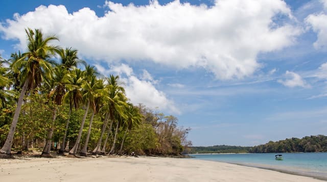
Most barrier islands on this coast run north to south; Sanibel runs east to west, and its southern shore therefore faces directly into the Gulf currents that carry shells up from the south, depositing them in quantity - the island is one of the best-known shelling beaches in the world, and the stooped posture of collectors has its own local name. Rules limit collection of live shells. More than half the island is wildlife refuge, the largest being J. N. Ding Darling National Wildlife Refuge, named for a cartoonist and conservationist, with a wildlife drive through mangrove and mudflat that is best at low tide for wading birds. Hurricane Ian heavily damaged the causeway and much of the island in September 2022, and the island has been rebuilding since.
What you'll find
- An east-west island - which is why the shells accumulate.
- Shelling beaches - among the best known anywhere.
- Ding Darling refuge - a wildlife drive through mangrove and flats.
- Continuing hurricane recovery - since Ian in 2022.
When to go
November to April; low tide after a storm is best for shells. A full day.
Before you go
Hurricane Ian caused severe damage in 2022 and recovery is incomplete - check what is open. Collecting live shells is prohibited and enforced. The causeway is tolled. Winter season fills the island and prices rise.
Nearby
Captiva is at the northern end; Fort Myers is inland.
What to pack for Sanibel Island
Chosen from what this place is for. Tap a kit for the full checklist.
- Reef-safe sunscreen - High SPF that will not bleach the coral you are swimming over. Find on Amazon
- Binoculars - The single best wildlife tool - even a compact pair transforms a sighting. Find on Amazon
- Quick-dry towel - A microfibre towel packs small and dries in minutes. Find on Amazon
- A zoom camera or long lens - Animals rarely come close; reach beats megapixels. Find on Amazon
Some links on this page are Amazon affiliate links - if you buy through them we may earn a small commission at no extra cost to you.
All packing kitsPlan your trip
Where to start if Sanibel Island is going on the list.
Booking links on this page are affiliate links - if you book through them we may earn a small commission at no extra cost to you. It never changes what we write about a place.
Opening times, ticket prices and seasonal closures change - check the official source before you go: official site.