Palouse Falls
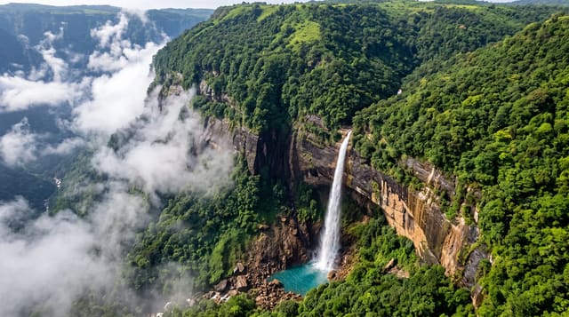
A waterfall dropping about sixty metres into a basalt amphitheatre in eastern Washington, cut by ice age floods.
Updated 21 October 2026
The falls drop about sixty metres into a circular basalt basin, and the canyon around them is a product of the Missoula Floods - repeated ice age outburst floods that scoured the Columbia Plateau and left the coulees, dry falls and channelled scablands across eastern Washington. The Palouse River now runs through a channel far larger than it could have cut. It was made Washington's state waterfall in 2014 after a campaign led by schoolchildren. There is no legal trail to the base and the informal route down is dangerous, as is swimming above the lip; the park has fenced and closed routes. Flow is strongest in spring and drops substantially by late summer.
What you'll find
- A drop of about sixty metres - into a circular basalt basin.
- A channel cut by ice age floods - far larger than the current river.
- Washington's state waterfall - designated in 2014.
- Scabland country around it - scoured plateau and dry coulees.
When to go
March to June for flow. Two hours.
What to expect
There is no legal route to the base. Swimming above the falls is dangerous. Late summer flow is much reduced. It is remote with no services and a Discover Pass is required.
Nearby
Lyons Ferry is south; the Palouse farmland is north.
Key facts
Source: Wikidata, item Q7128680, read on 18 October 2026.
What to pack for Palouse Falls
Chosen from what this place is for. Tap a kit for the full checklist.
- Broken-in walking shoes or boots - Grip and ankle support matter more than looks; never hike in brand-new boots. Find on Amazon
- Reef-safe sunscreen - High SPF that will not bleach the coral you are swimming over. Find on Amazon
- Layers + a waterproof shell - Mountain weather turns fast; a packable rain jacket saves the day. Find on Amazon
- Quick-dry towel - A microfibre towel packs small and dries in minutes. Find on Amazon
Some links on this page are Amazon affiliate links - if you buy through them we may earn a small commission at no extra cost to you.
All packing kitsPlan your trip
Where to start if Palouse Falls is going on the list.
Booking links on this page are affiliate links - if you book through them we may earn a small commission at no extra cost to you. It never changes what we write about a place.
Opening times, ticket prices and seasonal closures change - check the official source before you go: official site.