Malvern Hills
A narrow spine of ancient rock rising straight out of flat farmland, with springs that made a spa town and views claimed over thirteen counties.
Updated 20 October 2026
AI illustration
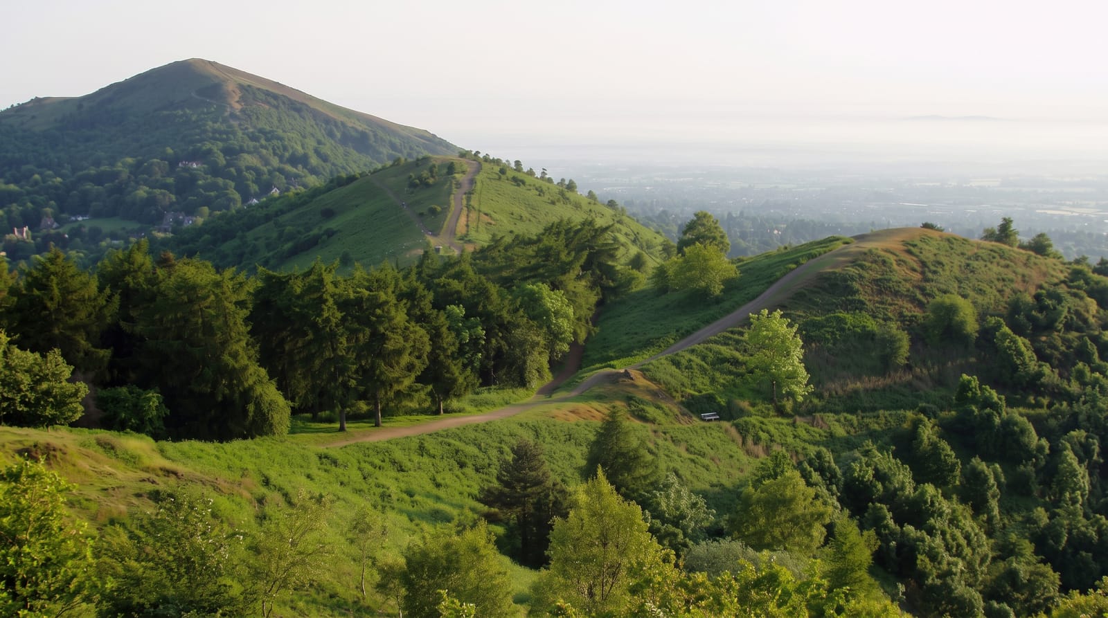
The hills are a ridge about thirteen kilometres long of Precambrian igneous and metamorphic rock, roughly 680 million years old, thrust up through much younger sedimentary country, which is why they rise so abruptly from level ground; the highest point, Worcestershire Beacon, is 425 metres and the view is claimed over as many as thirteen counties on the clearest days. The rock is so impermeable that water emerges pure at numerous springs, and Malvern water built the town as a hydrotherapy resort in the nineteenth century; the springs still run and people fill containers at them. British Camp on Herefordshire Beacon is a large Iron Age hillfort with ramparts terracing the whole hilltop. Elgar lived and walked here, and the hills are usually connected with his music.
The landscape
- The abrupt ridge - 680-million-year-old rock standing over flat farmland.
- British Camp - Iron Age ramparts terracing a whole hilltop.
- The springs - free-flowing water still collected in containers.
- The Beacon views - up to thirteen counties claimed in clear conditions.
When to go
April to October for walking; the ridge path is exposed and windy in any season. Clear winter days give the longest views. The Malvern spring and autumn garden shows fill the town.
Before you go
The climb from the town is steep whichever route is taken, gaining around three hundred metres. The ridge is busy on weekends and the car parks are charged. Fifteen-county visibility is rare, and haze usually cuts the view well short.
Nearby
Great Malvern and its priory lie below; Worcester and the Severn are east.
Key facts
Source: Wikidata, item Q1577855, read on 18 October 2026.
What to pack for Malvern Hills
Chosen from what this place is for. Tap a kit for the full checklist.
- Broken-in walking shoes or boots - Grip and ankle support matter more than looks; never hike in brand-new boots. Find on Amazon
- Layers + a waterproof shell - Mountain weather turns fast; a packable rain jacket saves the day. Find on Amazon
- Daypack with rain cover - 20-30 litres holds water, snacks, layers and a first-aid kit. Find on Amazon
- Offline maps + a power bank - Download the trail before you lose signal; carry backup charge. Find on Amazon
Some links on this page are Amazon affiliate links - if you buy through them we may earn a small commission at no extra cost to you.
All packing kitsPlan your trip
Where to start if Malvern Hills is going on the list.
Booking links on this page are affiliate links - if you book through them we may earn a small commission at no extra cost to you. It never changes what we write about a place.
Opening times, ticket prices and seasonal closures change - check the official source before you go: official site.