Lough Erne
Two linked lakes with over 150 islands, one holding stone figures with two faces carved back to back on an early Christian site.
Updated 4 September 2026

AI illustration
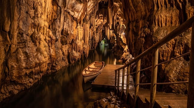
Lower and Upper Lough Erne together run about eighty kilometres through Fermanagh, joined at Enniskillen, and the lower lough alone holds over one hundred and fifty islands. Devenish Island has a monastery founded in the sixth century with a round tower of about thirty metres, complete with its conical cap, and a carved cornice unusual on such towers. White Island holds eight stone figures set into a wall, early medieval carvings whose meaning is disputed. On Boa Island in the Caldragh graveyard stands the Janus figure, a stone carving with a face on each side, probably Iron Age and among the strangest surviving carvings in Ireland. Marble Arch Caves nearby are a show cave system with an underground boat trip. The lough is a cruising water with hire boats and no locks on the lower section.
What you'll find
- The Boa Island Janus figure - a stone carving with a face on each side.
- Devenish round tower - a thirty-metre tower with its conical cap intact.
- The White Island figures - eight early medieval carvings set into a wall.
- The island cruising - over 150 islands on lock-free hire-boat water.
When to go
April to October for boats and island ferries, which run seasonally; the lough is quiet and often flooded in winter. Midges are present in still summer evenings.
Practical notes
Island access depends on seasonal ferries or a hire boat, and services are limited. Fermanagh is wet, with high rainfall year-round. Sites are scattered and a car is needed between them. Winter flooding closes lakeside roads.
Nearby
Enniskillen sits between the two loughs; Marble Arch Caves and the Cuilcagh boardwalk lie south.
Key facts
Source: Wikidata, item Q1324180, read on 18 October 2026.
What to pack for Lough Erne
Chosen from what this place is for. Tap a kit for the full checklist.
- Broken-in walking shoes or boots - Grip and ankle support matter more than looks; never hike in brand-new boots. Find on Amazon
- Head torch + spare batteries - Hands-free light is essential; caves are truly dark. Find on Amazon
- Modest clothing - Shoulders and knees covered - the single most common requirement. Find on Amazon
- Layers + a waterproof shell - Mountain weather turns fast; a packable rain jacket saves the day. Find on Amazon
Some links on this page are Amazon affiliate links - if you buy through them we may earn a small commission at no extra cost to you.
All packing kitsPlan your trip
Where to start if Lough Erne is going on the list.
Booking links on this page are affiliate links - if you book through them we may earn a small commission at no extra cost to you. It never changes what we write about a place.
Opening times, ticket prices and seasonal closures change - check the official source before you go: official site.