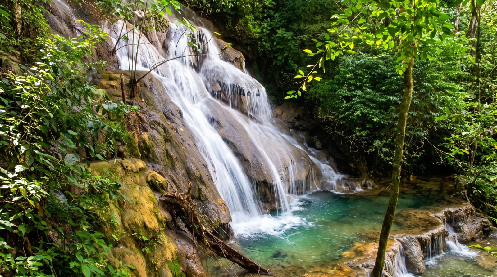
Palovit Waterfall
A powerful fall deep in the Kaçkar forest above Çamlıhemşin, reached up a rough valley road and heard before it is seen.
Updated 25 August 2026
Palovit drops around fifteen metres into a pool in the forest above Çamlıhemşin, and although the height is unremarkable the volume is not - this is the wettest region in Turkey, the catchment above is Kaçkar snowmelt and rain, and the fall runs hard enough to throw spray across the whole clearing and drown conversation. It sits within the Kaçkar Mountains national park in dense wet forest of spruce, beech and rhododendron, with moss on everything. Getting there means continuing up the Fırtına valley road past Zilkale on a narrowing, roughening track toward the Elevit and Palovit yaylas - slow, and unpleasant in a low car. There is a viewing platform and a path down toward the pool. The area was the subject of a long campaign against small hydroelectric schemes proposed on these streams, which is a live regional subject and directly relevant to how much water comes over the fall.
What you'll find
- The fall - heavy water into a forest pool.
- The spray - the clearing constantly wet from it.
- The Kaçkar forest - spruce, beech and rhododendron around.
- The valley road - the rough climb past Zilkale.
When to go
June to September; snowmelt in early summer gives the strongest flow. The road is impassable in winter and rough after heavy rain.
What to expect
The road is poor and slow - a high-clearance vehicle is advisable. Everything is wet and slippery. There are no facilities. Mist and rain are constant in this valley.
Nearby
Zilkale is back down the valley; Pokut plateau and Elevit yayla are above.
Key facts
Source: Wikidata, item Q61076472, read on 18 October 2026.
What to pack for Palovit Waterfall
Chosen from what this place is for. Tap a kit for the full checklist.
- Broken-in walking shoes or boots - Grip and ankle support matter more than looks; never hike in brand-new boots. Find on Amazon
- Layers + a waterproof shell - Mountain weather turns fast; a packable rain jacket saves the day. Find on Amazon
- Daypack with rain cover - 20-30 litres holds water, snacks, layers and a first-aid kit. Find on Amazon
- Offline maps + a power bank - Download the trail before you lose signal; carry backup charge. Find on Amazon
Some links on this page are Amazon affiliate links - if you buy through them we may earn a small commission at no extra cost to you.
All packing kitsPlan your trip
Where to start if Palovit Waterfall is going on the list.
Booking links on this page are affiliate links - if you book through them we may earn a small commission at no extra cost to you. It never changes what we write about a place.
Opening times, ticket prices and seasonal closures change - check the official source before you go: official site.