Doi Inthanon
The roof of Thailand - a 2,565-metre summit of cloud forest, twin royal pagodas and misty ridge trails above Chiang Mai's valleys.
Updated 21 October 2026
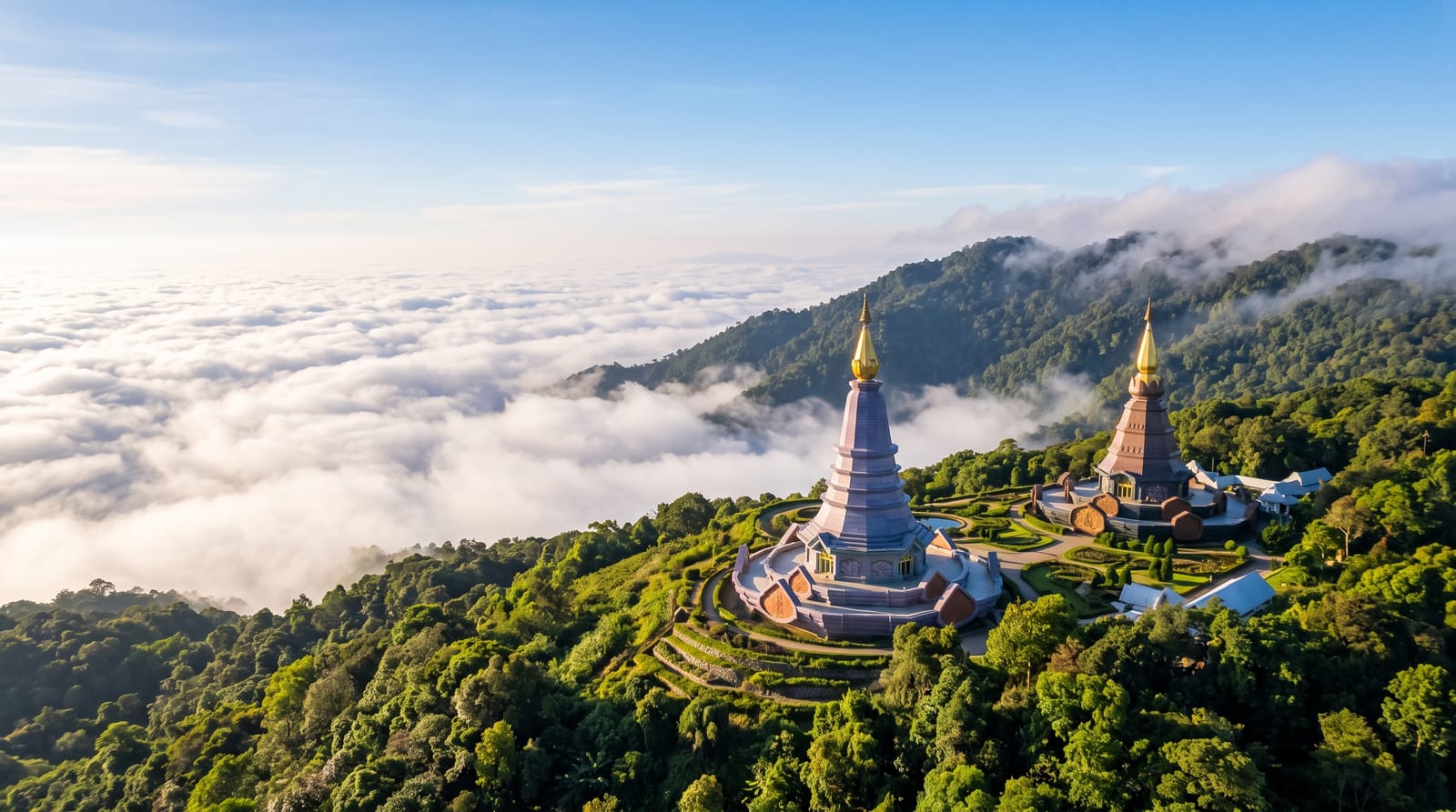
AI illustration
Doi Inthanon crowns the kingdom at 2,565 metres - the highest point in Thailand, named after Inthawichayanon, a prince of Chiang Mai who cared for the northern forests and whose remains rest on the mountain - riding the last shoulders of the Himalayan foothills above Chiang Mai's valleys. The summit itself hides in a dripping moss forest, but the mountain performs everywhere else: the twin royal pagodas built to honour the late king and queen stand on landscaped terraces with cloud-sea views, the Kew Mae Pan trail (guided, open November to May) walks a ridgeline over rhododendron cliffs, and Wachirathan's roadside waterfall throws spray at every passing car. Karen and Hmong villages farm coffee and strawberries on the slopes, winter dawns drop near freezing and occasionally frost the meadows - a national delight in the tropics - and the whole mountain packages itself as Chiang Mai's classic high-altitude day out, best begun before the light and the tour vans arrive.
The landscape
- The twin royal pagodas - terraced gardens and cloud-sea views near the summit.
- Kew Mae Pan ridge - the guided cliff-edge loop above the valley.
- Wachirathan waterfall - the roadside thunder on the ascent.
- The summit moss forest - Thailand's highest point in dripping green.
When to go
November to February for cool, clear mornings and the famous cloud seas - dawn is the appointment. The Kew Mae Pan trail closes June to October; frost mornings around New Year draw Thai crowds in wool hats.
Good to know
The summit sign sits in forest with no view - the pagodas and trails carry the scenery. Foreigner park fees plus vehicle charges add up, winter dawns are genuinely cold, and weekends jam the summit road. Kew Mae Pan requires hiring a local guide at the trailhead.
Nearby
Mae Ya and Mae Klang waterfalls, Mae Chaem's valley and Chiang Mai city.
Key facts
Source: Wikidata, item Q1140075, read on 18 October 2026.
What to pack for Doi Inthanon
Chosen from what this place is for. Tap a kit for the full checklist.
- Broken-in walking shoes or boots - Grip and ankle support matter more than looks; never hike in brand-new boots. Find on Amazon
- Binoculars - The single best wildlife tool - even a compact pair transforms a sighting. Find on Amazon
- Layers for big temperature swings - Warm sun by day, near-freezing at night, even near the equator. Find on Amazon
- Layers + a waterproof shell - Mountain weather turns fast; a packable rain jacket saves the day. Find on Amazon
Some links on this page are Amazon affiliate links - if you buy through them we may earn a small commission at no extra cost to you.
All packing kitsPlan your trip
Where to start if Doi Inthanon is going on the list.
Booking links on this page are affiliate links - if you book through them we may earn a small commission at no extra cost to you. It never changes what we write about a place.
Opening times, ticket prices and seasonal closures change - check the official source before you go: official site.