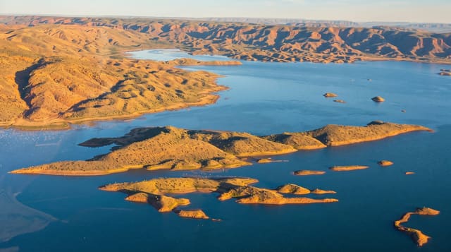
Kayrakkum Reservoir
A large reservoir on the Syr Darya near Khujand, used for swimming and sailing and known as the Tajik Sea.
Updated 16 October 2026
The Kayrakkum reservoir was created in the 1950s by damming the Syr Darya east of Khujand, flooding a stretch of the valley to create a body of water around five hundred square kilometres that people in the north call the Tajik Sea. Sanatoria and holiday resorts line parts of the shore, and it is the main swimming and boating place for the Sughd region. Waterbirds use the shallows, and the water level fluctuates with the dam.
Background
The reservoir lies in Ghafurov District, in the western Fergana Valley, and its dam stands about 15 kilometres east of Khujand. Work on the Kayrakkum Dam, built for irrigation and hydroelectric power, began on the Kayrakkum steppe in July 1951. The dam was finished in 1956, when the reservoir began to fill. The lake covers 523 square kilometres, is 56 kilometres long and up to 15 kilometres wide, and reaches its maximum depth of 25 metres near the dam. Silt fills its upper end for 10 to 15 kilometres, and by 2009 silt had taken an estimated one-third of its volume. It became a Ramsar site on 18 July 2001.
Source: Wikipedia, "Kayrakkum Reservoir"
The landscape
- The open water - a reservoir of around five hundred square kilometres.
- The resort shore - sanatoria and holiday places along the northern bank.
- The swimming beaches - the main bathing place for the northern region.
- The waterbirds - species using the shallows and margins.
When to go
May to September is the season for swimming. Summer is very hot in the valley. Water levels drop through the irrigation season.
Practical notes
Resorts are dated Soviet-era facilities in variable repair. Water levels and clarity vary a great deal. Summer heat in the Fergana valley is severe.
Nearby
Khujand is west, and Istaravshan is south.
Key facts
Source: Wikidata, item Q668883, read on 18 October 2026.
What to pack for Kayrakkum Reservoir
Chosen from what this place is for. Tap a kit for the full checklist.
- Broken-in walking shoes or boots - Grip and ankle support matter more than looks; never hike in brand-new boots. Find on Amazon
- Reef-safe sunscreen - High SPF that will not bleach the coral you are swimming over. Find on Amazon
- Layers + a waterproof shell - Mountain weather turns fast; a packable rain jacket saves the day. Find on Amazon
- Quick-dry towel - A microfibre towel packs small and dries in minutes. Find on Amazon
Some links on this page are Amazon affiliate links - if you buy through them we may earn a small commission at no extra cost to you.
All packing kitsPlan your trip
Where to start if Kayrakkum Reservoir is going on the list.
Booking links on this page are affiliate links - if you book through them we may earn a small commission at no extra cost to you. It never changes what we write about a place.
Opening times, ticket prices and seasonal closures change - check the official source before you go: official site.