Alangyi Ancient Trail
The last stretch of Taiwanese coast with no road, walked in a day along cobble beaches between Pingtung and Taitung.
Updated 2 September 2026
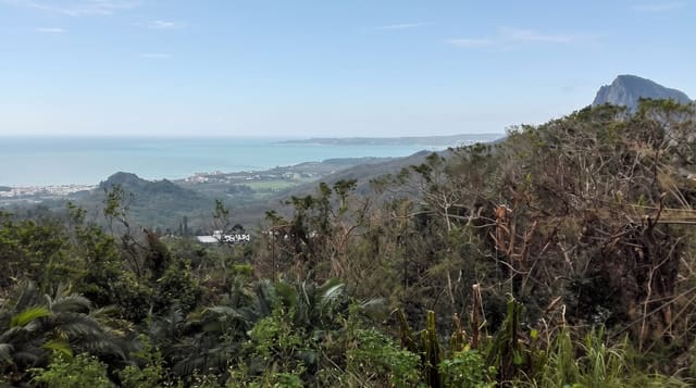
Highway 26 runs around most of Taiwan's coast but a gap of some eight kilometres was never built, and the Alangyi trail crosses it: a route along cobble beaches and over a headland that Paiwan people and Dutch and Qing officials used before roads. Proposals to complete the highway were fought off and the section is now protected. Walking it requires a permit and a licensed guide, numbers are capped, and the tide dictates the timing.
What's there
- The roadless coast - the last section of Taiwan's shoreline without a highway.
- The cobble beaches - rounded stone shore walked for most of the route.
- The headland climb - the section over Guanyin Nose where the shore is impassable.
- The Pacific - open ocean the whole way with no development in sight.
When to go
October to April is the driest and calmest. Summer typhoons close the route. Timing is set by the tide and by the guide, not by the walker.
What to expect
A permit and a licensed guide are both compulsory and numbers are limited daily. The walk is on loose cobble which is hard going. There is no shade, no water and no exit once started.
Nearby
Xuhai is the southern end, and Taitung county begins at the northern end.
What to pack for Alangyi Ancient Trail
Chosen from what this place is for. Tap a kit for the full checklist.
- Broken-in walking shoes or boots - Grip and ankle support matter more than looks; never hike in brand-new boots. Find on Amazon
- Reef-safe sunscreen - High SPF that will not bleach the coral you are swimming over. Find on Amazon
- Comfortable walking shoes - Sightseeing means kilometres of pavement and cobbles daily. Find on Amazon
- Layers + a waterproof shell - Mountain weather turns fast; a packable rain jacket saves the day. Find on Amazon
Some links on this page are Amazon affiliate links - if you buy through them we may earn a small commission at no extra cost to you.
All packing kitsPlan your trip
Where to start if Alangyi Ancient Trail is going on the list.
Booking links on this page are affiliate links - if you book through them we may earn a small commission at no extra cost to you. It never changes what we write about a place.
Opening times, ticket prices and seasonal closures change - check the official source before you go: official site.