Jan Mayen
A volcanic island in the Norwegian Sea with a small station and no public transport.
Updated 16 October 2026
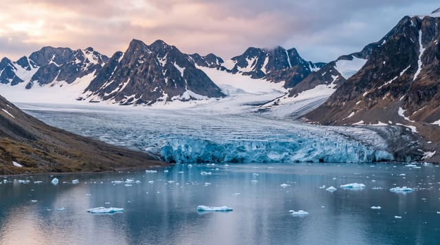
Jan Mayen lies alone in the Norwegian Sea between Iceland and Svalbard, a narrow volcanic island around fifty five kilometres long with the Beerenberg volcano at its northern end and a low isthmus running south. Around eighteen people staff a joint meteorological and navigation station at Olonkinbyen; there is no other population. The whole island is a nature reserve, and visits require permission from Norwegian authorities.
Background
The island covers 377 square kilometres, and glaciers cover 114.2 square kilometres of it, around the Beerenberg volcano, which rises to 2277 m. No subaerial active volcano in the world lies further north than Beerenberg. Jan Mayen has two parts, the larger Nord-Jan and the smaller Sør-Jan, joined by an isthmus 2.5 kilometres wide that holds the two largest lakes, Sørlaguna and Nordlaguna. Geologists class it as a microcontinent formed by the Jan Mayen hotspot. It lies 600 kilometres northeast of Iceland and 500 kilometres east of central Greenland. The 124.1 kilometres of coast have no ports or harbours, only offshore anchorages, and the one airstrip, Jan Mayensfield, is unpaved and about 1585 metres long.
Source: Wikipedia, "Jan Mayen"
The landscape
- The island shape - a narrow strip with the volcano at one end and lowland south.
- Olonkinbyen - the station that is the island's only settlement.
- The nature reserve - protection covering effectively the whole island.
- The isolation - alone in the Norwegian Sea between Iceland and Svalbard.
When to go
June to August is the only practical window. There is no scheduled transport at any time. Fog is very frequent around the island.
What to expect
There is no scheduled transport and visits require Norwegian permission; the station cannot host tourists. Landing is by small boat and often prevented by swell. Fog closes the island for long stretches.
Nearby
Beerenberg is at the northern end, and Iceland is southwest.
Key facts
Source: Wikidata, item Q14056, read on 18 October 2026.
What to pack for Jan Mayen
Chosen from what this place is for. Tap a kit for the full checklist.
- Reef-safe sunscreen - High SPF that will not bleach the coral you are swimming over. Find on Amazon
- Warm base layers - Merino or synthetic against the skin - never cotton, which chills when damp. Find on Amazon
- Quick-dry towel - A microfibre towel packs small and dries in minutes. Find on Amazon
- An insulated + windproof jacket - A down or synthetic layer under a hard shell handles most cold. Find on Amazon
Some links on this page are Amazon affiliate links - if you buy through them we may earn a small commission at no extra cost to you.
All packing kitsPlan your trip
Where to start if Jan Mayen is going on the list.
Booking links on this page are affiliate links - if you book through them we may earn a small commission at no extra cost to you. It never changes what we write about a place.
Opening times, ticket prices and seasonal closures change - check the official source before you go: official site.