Adam's Bridge Marine National Park
A chain of sandbanks and shoals running west from Mannar towards India, declared a marine national park in 2015.
Updated 20 October 2026
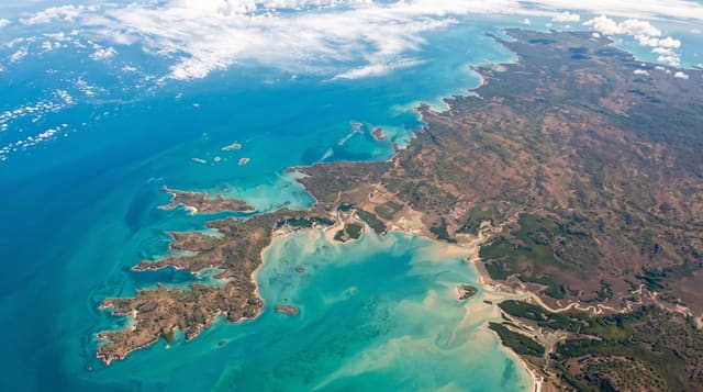
Adam's Bridge, also called Rama's Bridge, is a chain of limestone shoals and sandbanks running some 48 kilometres from Mannar Island to India's Pamban Island, mostly submerged but with several banks exposed at low water. Geological evidence suggests it was once a land connection between India and Sri Lanka. The Sri Lankan section became a marine national park in 2015, protecting seagrass beds, dugongs, dolphins and enormous numbers of migratory birds using the sandbanks.
What's there
- The sandbanks - exposed shoals in a chain running west towards India.
- The seagrass beds - dugong habitat in the shallow water around the banks.
- The migratory birds - terns, gulls and waders using the banks in numbers.
- The clear shallows - very shallow turquoise water over pale sand.
When to go
December to March is the calmest and the best for birds. Boats depend entirely on sea conditions and are cancelled often. Summer is hot and the light is harsh.
Things to know
Boat access requires a permit and is frequently cancelled for weather. There is no infrastructure and no shade on the banks. Landing is restricted in parts of the park.
Nearby
Talaimannar is at the eastern end, and Mannar town is east.
Key facts
Source: Wikidata, item Q24044820, read on 18 October 2026.
What to pack for Adam's Bridge Marine National Park
Chosen from what this place is for. Tap a kit for the full checklist.
- Broken-in walking shoes or boots - Grip and ankle support matter more than looks; never hike in brand-new boots. Find on Amazon
- Reef-safe sunscreen - High SPF that will not bleach the coral you are swimming over. Find on Amazon
- Binoculars - The single best wildlife tool - even a compact pair transforms a sighting. Find on Amazon
- Layers + a waterproof shell - Mountain weather turns fast; a packable rain jacket saves the day. Find on Amazon
Some links on this page are Amazon affiliate links - if you buy through them we may earn a small commission at no extra cost to you.
All packing kitsPlan your trip
Where to start if Adam's Bridge Marine National Park is going on the list.
Booking links on this page are affiliate links - if you book through them we may earn a small commission at no extra cost to you. It never changes what we write about a place.
Opening times, ticket prices and seasonal closures change - check the official source before you go: official site.