Ulleungdo Island
A steep volcanic island far out in the East Sea - sea cliffs, a coastal road cut into rock, squid boats and almost no flat ground.
Updated 20 October 2026
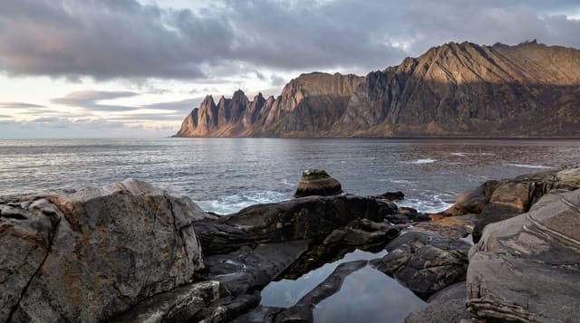
Ulleungdo lies about a hundred and twenty kilometres out in the East Sea, an extinct volcano rising straight from deep water, and it is unlike anywhere else in Korea: almost no flat land, villages wedged into the few coves, a road round the island cut into and tunnelled through cliffs, and forest running up to Seonginbong at 984 metres. Nari Basin, the old caldera floor, is the only level ground and grows the island's vegetables. The coastal walkways at Haengnam and Gwaneumdo, the Bongnae falls, the Jeodong seawalk and the observatory cable car are the standard circuit. Squid is the economy and the drying racks are everywhere. Getting there is the constraint: the crossing takes three to four hours and is exposed enough that sailings are cancelled regularly, sometimes for days, so anyone going should carry slack in their plans and expect to be stuck at either end.
What's there
- The cliff road - the route tunnelled round the island.
- Nari Basin - the caldera floor and its fields.
- The coastal walkways - boardwalks at Haengnam and Gwaneumdo.
- The squid racks - drying frames through the villages.
When to go
May to June and September to October for the calmest crossings. Winter sailings are frequently cancelled and the island can be cut off for days.
What to expect
Ferry cancellations are common and strand people at both ends - never plan a tight connection. The crossing is rough and seasickness is normal. Accommodation and food are limited and prices reflect the shipping.
Nearby
Dokdo tours run from the island when seas allow; Pohang and Gangneung are the mainland ports.
Key facts
Source: Wikidata, item Q41172, read on 18 October 2026.
What to pack for Ulleungdo Island
Chosen from what this place is for. Tap a kit for the full checklist.
- Reef-safe sunscreen - High SPF that will not bleach the coral you are swimming over. Find on Amazon
- Spare batteries + cards - Cold and long shoots drain power; never run out at the good light. Find on Amazon
- Quick-dry towel - A microfibre towel packs small and dries in minutes. Find on Amazon
- A compact tripod - Essential for night skies, aurora, waterfalls and low light. Find on Amazon
Some links on this page are Amazon affiliate links - if you buy through them we may earn a small commission at no extra cost to you.
All packing kitsPlan your trip
Where to start if Ulleungdo Island is going on the list.
Booking links on this page are affiliate links - if you book through them we may earn a small commission at no extra cost to you. It never changes what we write about a place.
Opening times, ticket prices and seasonal closures change - check the official source before you go: official site.