Veľká Fatra National Park
A range of long grassy ridges and deep forested valleys between Turiec and Liptov, quieter than the Tatras.
Updated 16 October 2026
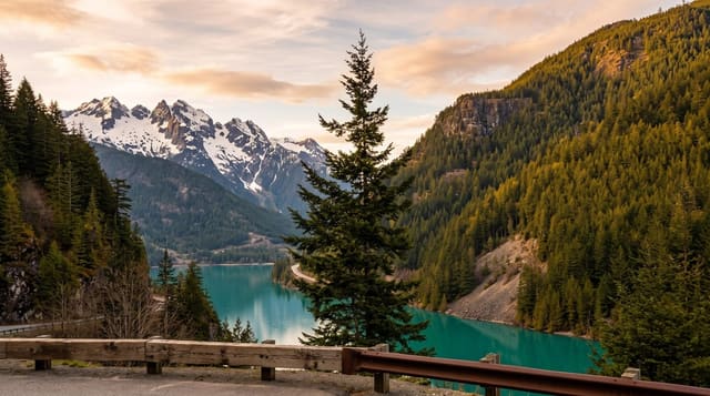
The Veľká Fatra runs for some fifty kilometres between the Turiec and Váh valleys, and its character is different from the Tatras: rounded limestone and dolomite ridges carrying long open grassy crests, with deep forested valleys and gorges below them, and yew forest at Harmanec that is among the largest in Europe. The main ridge walk from Donovaly to Krížna and beyond is one of the classic Slovak traverses.
Background
The park was declared on 1 April 2002, upgrading the protected landscape area of the same name set up in 1972, and it spans 40371.34 hectares, mostly in the southern Žilina Region with a small part in Banská Bystrica Region. Carpathian forest dominated by European beech covers 90% of the area, alongside ridge-top cattle pastures that go back to the 15th to 17th centuries. A granite core reaches the surface only in places. Slates form the gentle ridges of the Hôlna Fatra, while limestone and dolomite create the rugged Bralná Fatra and its caves, of which Harmanec Cave alone is open to the public. Brown bear, grey wolf and Eurasian lynx all live here.
Source: Wikipedia, "Veľká Fatra National Park"
What you'll find
- The open ridges - long grassy crests with views along the whole range.
- The Harmanec yews - one of the largest yew stands in Europe.
- The gorges - Blatnicka and Gaderska valleys cutting into the range.
- The Krizna traverse - a classic long ridge walk across the massif.
When to go
June to October is the walking season, with the ridge meadows flowering in June and July. Snow lies on the crests from November to May. Bears are present and food should be handled accordingly.
Things to know
Water is scarce on the ridges and must be carried. Bears are genuinely present and encounters happen. Marked trails are good but the distances are long between huts.
Nearby
Mala Fatra is northwest, and the Low Tatras are east.
Key facts
Source: Wikidata, item Q958003, read on 18 October 2026.
What to pack for Veľká Fatra National Park
Chosen from what this place is for. Tap a kit for the full checklist.
- Broken-in walking shoes or boots - Grip and ankle support matter more than looks; never hike in brand-new boots. Find on Amazon
- Head torch + spare batteries - Hands-free light is essential; caves are truly dark. Find on Amazon
- Binoculars - The single best wildlife tool - even a compact pair transforms a sighting. Find on Amazon
- Warm base layers - Merino or synthetic against the skin - never cotton, which chills when damp. Find on Amazon
Some links on this page are Amazon affiliate links - if you buy through them we may earn a small commission at no extra cost to you.
All packing kitsPlan your trip
Where to start if Veľká Fatra National Park is going on the list.
Booking links on this page are affiliate links - if you book through them we may earn a small commission at no extra cost to you. It never changes what we write about a place.
Opening times, ticket prices and seasonal closures change - check the official source before you go: official site.