Mesopotamia Valley
A steep farmed valley in St Vincent's interior, terraced with breadfruit, banana and root crops.
Updated 3 September 2026
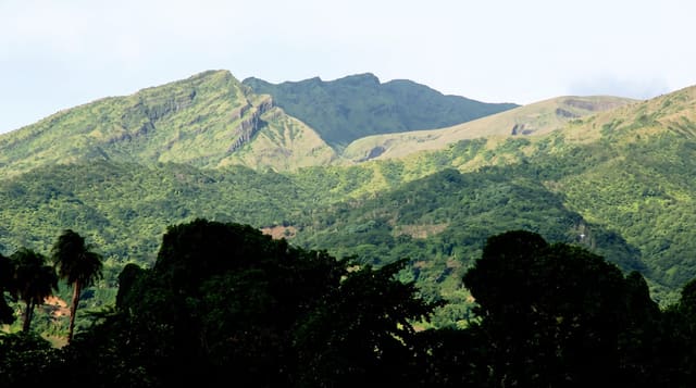
The Mesopotamia valley, called Marriaqua locally, runs inland from the windward side of St Vincent between ridges that rise steeply on both sides, and the whole of it is cultivated: breadfruit, banana, plantain, dasheen, nutmeg and cocoa worked on terraces up slopes that look too steep to farm. It is the agricultural heart of the island and the road through it is one of the more spectacular drives in the eastern Caribbean.
Highlights
- The terraced slopes - cultivation running up hillsides that look too steep to work.
- The crop mix - breadfruit, banana, dasheen, nutmeg and cocoa together.
- The valley road - the drive through between the ridges.
- The green depth - a valley kept wet by high rainfall in the interior.
When to go
December to May is the dry season and best for the drive. Rain is frequent at any time inland. Mornings are clearest.
What to expect
The roads are narrow, steep and winding with heavy local traffic. There is nothing built for visitors along the valley. Rain closes the views frequently.
Nearby
Belmont Lookout is above, and Montreal Gardens are at the head of the valley.
What to pack for Mesopotamia Valley
Chosen from what this place is for. Tap a kit for the full checklist.
- Broken-in walking shoes or boots - Grip and ankle support matter more than looks; never hike in brand-new boots. Find on Amazon
- Layers + a waterproof shell - Mountain weather turns fast; a packable rain jacket saves the day. Find on Amazon
- Daypack with rain cover - 20-30 litres holds water, snacks, layers and a first-aid kit. Find on Amazon
- Offline maps + a power bank - Download the trail before you lose signal; carry backup charge. Find on Amazon
Some links on this page are Amazon affiliate links - if you buy through them we may earn a small commission at no extra cost to you.
All packing kitsPlan your trip
Where to start if Mesopotamia Valley is going on the list.
Booking links on this page are affiliate links - if you book through them we may earn a small commission at no extra cost to you. It never changes what we write about a place.
Opening times, ticket prices and seasonal closures change - check the official source before you go: official site.
Keep exploring


← More nature & outdoors in Saint Vincent and the Grenadines