Mount Iremel
A flat-topped quartzite mountain in the Southern Urals, held sacred by Bashkirs and climbed on a boardwalk route.
Updated 28 August 2026
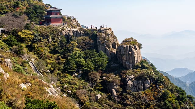
Iremel is the second-highest mountain in the Southern Urals at 1,582 metres, a broad quartzite massif with two summits and a flat stony plateau on top - Bolshoy Iremel and Maly Iremel - rising above spruce forest that gives way to dwarf birch, then to bare rock and kurum, the fields of angular blocks that cover Ural summits. It is sacred in Bashkir tradition and was, according to that tradition, not climbed casually; people still tie ribbons at the treeline. The standard route starts at Tyulyuk on the Chelyabinsk side and runs about fourteen kilometres each way, with a boardwalk laid over the worst of the bog and root damage after visitor numbers grew sharply. Permits are required from the natural park. The summit plateau holds snow into July and weather turns fast; below it the taiga is thick, and bears are present.
The landscape
- The plateau summit - flat stony ground at 1,582 metres above the treeline.
- The kurum - fields of angular blocks covering the upper slopes.
- The Bashkir tradition - a sacred mountain with ribbons tied at the treeline.
- The boardwalk - laid to protect ground damaged by rising visitor numbers.
When to go
June to September for the walk; March for ski touring. A full day - fourteen kilometres each way. Permits from the park are compulsory.
Things to know
Twenty-eight kilometres round trip with a summit at 1,582 metres is a long day, and people underestimate it. Snow lies on the plateau into July. Weather changes fast with no shelter. Bears are present and the trail is remote. Permits are checked.
Nearby
Tyulyuk is the trailhead village; Zyuratkul national park is north-east.
What to pack for Mount Iremel
Chosen from what this place is for. Tap a kit for the full checklist.
- Broken-in walking shoes or boots - Grip and ankle support matter more than looks; never hike in brand-new boots. Find on Amazon
- Warm base layers - Merino or synthetic against the skin - never cotton, which chills when damp. Find on Amazon
- Layers for big temperature swings - Warm sun by day, near-freezing at night, even near the equator. Find on Amazon
- Modest clothing - Shoulders and knees covered - the single most common requirement. Find on Amazon
Some links on this page are Amazon affiliate links - if you buy through them we may earn a small commission at no extra cost to you.
All packing kitsPlan your trip
Where to start if Mount Iremel is going on the list.
Booking links on this page are affiliate links - if you book through them we may earn a small commission at no extra cost to you. It never changes what we write about a place.
Opening times, ticket prices and seasonal closures change - check the official source before you go: official site.