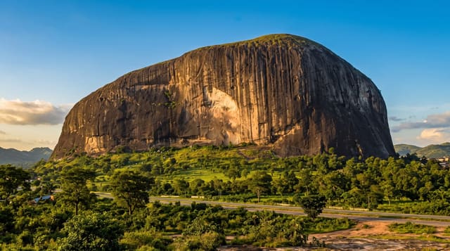
Manpupuner Rock Formations
Seven stone pillars up to forty-two metres tall on a remote Urals plateau, reachable only by helicopter or a long trek.
Updated 21 October 2026
Manpupuner - the name is Mansi and is usually rendered as the little mountain of the idols - is a line of seven pillars standing on a bare plateau in the northern Urals, between thirty and forty-two metres tall, six of them along the cliff edge and one, about thirty-four metres, standing apart; in 2008 they were voted one of the Seven Wonders of Russia. They are what is left of a mountain: hard sericite-quartzite schists that resisted two hundred million years of frost, wind and water while everything softer around them wore away. The Mansi, the indigenous people of these mountains, held the site sacred and traditionally did not climb the plateau. It is inside the Pechoro-Ilychsky nature reserve, a UNESCO site as part of the Virgin Komi Forests, and access is deliberately hard: a permit from the reserve, and then either a helicopter charter, which is expensive and weather-dependent, or a trek of several days each way through taiga and swamp with river crossings. The Dyatlov Pass, which draws its own visitors, is south along the same range.
The landscape
- The seven pillars - quartzite remnants up to forty-two metres on a bare plateau.
- The erosion - two hundred million years that removed the mountain around them.
- The Mansi significance - a sacred site the indigenous people did not climb.
- The access barrier - permits, and then a helicopter or a multi-day trek.
When to go
July to September for trekking; winter snowmobile routes exist. Five days to two weeks on foot, or a long day by helicopter. Permits must be arranged months ahead.
What to expect
Permits are limited and compulsory; going without one is illegal. Helicopter charters are expensive and cancelled by weather regularly. The trek is genuinely hard - swamp, river crossings, bears and no rescue. There are no facilities on the plateau.
Nearby
The Virgin Komi Forests surround it; Yugyd Va national park is north.
Key facts
Source: Wikidata, item Q2155757, read on 18 October 2026.
What to pack for Manpupuner Rock Formations
Chosen from what this place is for. Tap a kit for the full checklist.
- Broken-in walking shoes or boots - Grip and ankle support matter more than looks; never hike in brand-new boots. Find on Amazon
- Modest clothing - Shoulders and knees covered - the single most common requirement. Find on Amazon
- Shelter suited to the place - Tent, tarp or hut booking - match it to the terrain and rules. Find on Amazon
- Layers + a waterproof shell - Mountain weather turns fast; a packable rain jacket saves the day. Find on Amazon
Some links on this page are Amazon affiliate links - if you buy through them we may earn a small commission at no extra cost to you.
All packing kitsPlan your trip
Where to start if Manpupuner Rock Formations is going on the list.
Booking links on this page are affiliate links - if you book through them we may earn a small commission at no extra cost to you. It never changes what we write about a place.
Opening times, ticket prices and seasonal closures change - check the official source before you go: official site.