Katun River
The turquoise river that drains Belukha and runs the length of the Altai, rafted hard in its upper reaches.
Updated 21 October 2026
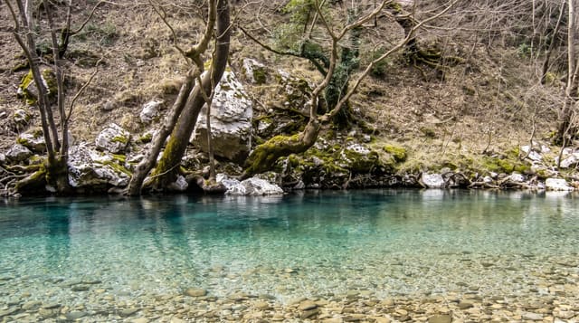
The Katun rises on the southern slope of Belukha, runs about six hundred and eighty kilometres and joins the Biya near Biysk to form the Ob. Its colour is the first thing people notice: a strong turquoise for much of the year, from glacial rock flour suspended in the water, going grey-brown at high melt in spring and clearest in autumn when the glaciers stop feeding it. The upper river above Inya carries serious whitewater - the Akkemsky and Shabash rapids among others - and multi-day rafting trips are a fixture of Russian river running. Below Chemal it eases into the wide braided reaches where the tourist strip along the Chuysky Trakt sits, with resorts, bridges, the Chemal hydro station and the Patmos island chapel. The confluence with the Chuya at Chuy-Oozy is a marked viewpoint and a traditional Altai sacred place.
What you'll find
- The colour - turquoise from glacial flour, changing with the melt season.
- The upper rapids - serious whitewater above Inya, run on multi-day trips.
- The Chuya confluence - the marked viewpoint at Chuy-Oozy, a sacred place.
- The lower strip - resorts and bridges along the Chuysky Trakt below Chemal.
When to go
June to September for rafting; May for the highest water and hardest grades. Autumn for the clearest colour. A day on the lower river, up to two weeks on a full descent.
Before you go
Upper Katun whitewater is genuinely dangerous - go with a proper operator and be honest about experience. Water is glacier-cold year-round. The lower river strip is heavily developed and crowded in August. Sacred sites along the river deserve respect.
Nearby
Chemal and Patmos are on the lower river; Tyungur and Belukha are upstream.
Key facts
Source: Wikidata, item Q723864, read on 18 October 2026.
What to pack for Katun River
Chosen from what this place is for. Tap a kit for the full checklist.
- Broken-in walking shoes or boots - Grip and ankle support matter more than looks; never hike in brand-new boots. Find on Amazon
- Quick-dry clothing - Board shorts or synthetics that shrug off spray and dry fast. Find on Amazon
- Warm base layers - Merino or synthetic against the skin - never cotton, which chills when damp. Find on Amazon
- Modest clothing - Shoulders and knees covered - the single most common requirement. Find on Amazon
Some links on this page are Amazon affiliate links - if you buy through them we may earn a small commission at no extra cost to you.
All packing kitsPlan your trip
Where to start if Katun River is going on the list.
Booking links on this page are affiliate links - if you book through them we may earn a small commission at no extra cost to you. It never changes what we write about a place.
Opening times, ticket prices and seasonal closures change - check the official source before you go: official site.