Rúpac
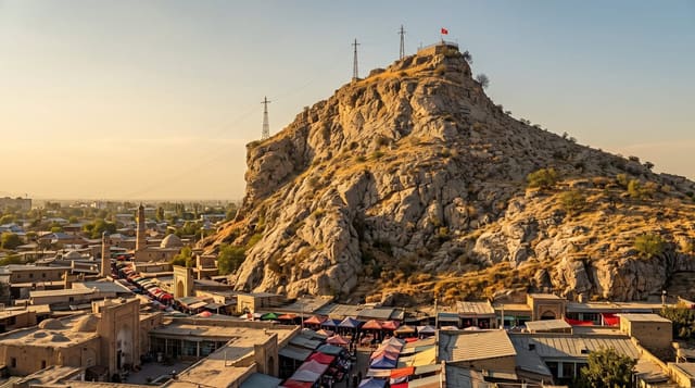
Stone towers of the Atavillos on a ridge above the clouds, reached by a hard climb from the village of Florida.
Updated 28 August 2026
Rúpac sits on a ridge at about 3,500 metres above the Chancay valley, and it is the best-preserved of the Atavillos sites - a settlement of stone buildings, many of them kullpi, tall funerary and residential towers with corbelled stone roofs still intact after six or seven centuries, which is rare. The Atavillos were the people of these highlands before the Inca absorbed them. What has made Rúpac popular with Limeños is the cloud: on many mornings the valley below fills with a solid layer while the ridge stays clear, so people camp overnight and wake above a white sea, and the site is marketed as the Machu Picchu limeño, which oversells it. The climb from Florida is three to four hours, steep and exposed, and almost everyone camps at the top because there is no way to do it as a day trip from Lima.
What you'll find
- The kullpi towers - stone buildings with corbelled roofs still standing intact.
- The cloud layer - the valley filling below the ridge on many mornings.
- The Atavillos - a pre-Inca highland people of the Chancay headwaters.
- The setting - a ridge at 3,500 metres with no road access.
When to go
May to October for the cloud inversions and dry paths. Two days, camping at the site; guides and mules can be arranged in Florida. Weekends are busy.
What to expect
A steep three to four hour climb with full camping gear, at altitude. No water at the top - carry it all. Nights are cold. The site can be crowded with weekend campers, and litter has become a problem. The cloud sea is weather-dependent and does not always appear.
Nearby
Florida is the trailhead village; Huaral and the coast road are west.
Key facts
Source: Wikidata, item Q26939478, read on 18 October 2026.
What to pack for Rúpac
Chosen from what this place is for. Tap a kit for the full checklist.
- Layers for big temperature swings - Warm sun by day, near-freezing at night, even near the equator. Find on Amazon
- Comfortable walking shoes - Sightseeing means kilometres of pavement and cobbles daily. Find on Amazon
- Shelter suited to the place - Tent, tarp or hut booking - match it to the terrain and rules. Find on Amazon
- Extra-strong sun protection - Thin air means fierce UV; hat, sunglasses and high-SPF sunscreen. Find on Amazon
Some links on this page are Amazon affiliate links - if you buy through them we may earn a small commission at no extra cost to you.
All packing kitsPlan your trip
Where to start if Rúpac is going on the list.
Booking links on this page are affiliate links - if you book through them we may earn a small commission at no extra cost to you. It never changes what we write about a place.
Opening times, ticket prices and seasonal closures change - check the official source before you go: official site.