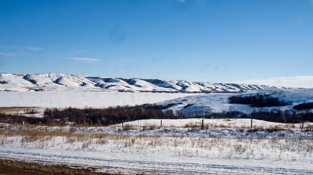
Quilcayhuanca Valley
A wide flat-bottomed valley of meadows and grazing cattle east of Huaraz, with ice peaks at the head and hardly any walkers.
Updated 28 August 2026
Quilcayhuanca is the valley people walk when they want the Cordillera Blanca without the traffic. It starts at the same Pitec trailhead as Laguna Churup and runs east as a classic U-shaped glacial trough, flat-floored, several hundred metres wide, grazed by cattle, with walls rising to Andavite and Cayesh and the Tullparaju glaciers at the head. The walking is gentle for the first two days - almost no gradient along the valley bottom - which makes it an unusually forgiving multi-day route, and the standard circuit continues over the Huapi pass at about 5,000 metres into the Cojup valley and back to Pitec, a three or four day loop. There are lakes on side branches, Tullparaju and Cuchillacocha, both dammed for flood control after historic glacial lake outbursts. The valley is boggy in parts and river crossings can be awkward.
The landscape
- The trough - a wide flat glacial valley floor with grazing cattle.
- Cayesh and Tullparaju - the ice peaks and glaciers closing the head.
- The lakes - Tullparaju and Cuchillacocha, both engineered against outburst floods.
- The Huapi pass - the 5,000-metre crossing into the Cojup valley.
When to go
May to September. Two days out and back, or three to four for the loop over Huapi into Cojup. Camping is self-supported; there are no huts.
Things to know
Boggy ground on the valley floor and river crossings that rise with rain. The loop pass is at 5,000 metres and needs acclimatisation. No infrastructure, no reliable phone signal, cattle throughout. Fewer people than Santa Cruz, which is the reason to come.
Nearby
Laguna Churup shares the trailhead; Huaraz is below.
What to pack for Quilcayhuanca Valley
Chosen from what this place is for. Tap a kit for the full checklist.
- Broken-in walking shoes or boots - Grip and ankle support matter more than looks; never hike in brand-new boots. Find on Amazon
- Warm base layers - Merino or synthetic against the skin - never cotton, which chills when damp. Find on Amazon
- Layers for big temperature swings - Warm sun by day, near-freezing at night, even near the equator. Find on Amazon
- Shelter suited to the place - Tent, tarp or hut booking - match it to the terrain and rules. Find on Amazon
Some links on this page are Amazon affiliate links - if you buy through them we may earn a small commission at no extra cost to you.
All packing kitsPlan your trip
Where to start if Quilcayhuanca Valley is going on the list.
Booking links on this page are affiliate links - if you book through them we may earn a small commission at no extra cost to you. It never changes what we write about a place.
Opening times, ticket prices and seasonal closures change - check the official source before you go: official site.