Cotahuasi Canyon
A remote canyon in northern Arequipa, deeper than the Colca and reached only after a long overnight drive.
Updated 2 October 2026
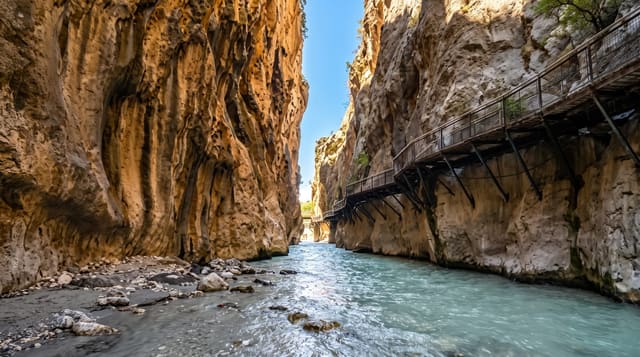
Cotahuasi cuts through the western Andes north of Arequipa and is measured as deeper than the Colca, which makes it one of the deepest canyons anywhere, though depth in a canyon this wide is a statistic rather than something you see in a single view. What you do see is a river running far below terraced slopes, villages built in stone and reached by footpaths, and the Sipia falls, where the whole river drops into a narrow gorge in one stage. Hot springs sit at Luicho on the way in. The road from Arequipa takes most of a day or a night, which keeps numbers low and makes this a walking destination.
The landscape
- Sipia falls - the river dropping into a narrow slot, reached on a walking path from the road.
- The terraced valley villages - stone settlements on the slopes, linked by footpaths.
- Luicho hot springs - thermal pools beside the river on the approach road.
- The canyon depths - the river far below the rim, seen from points along the road and trails.
When to go
April to November is dry and the roads are open; the wet season brings landslides that can close the route for days. Nights are cold at the higher points and the canyon floor is hot at midday, so you need clothes for both. Travel in and out uses two days of any trip whatever else you plan. Buses run overnight.
What to expect
The journey is the main cost: ten to twelve hours each way on a road that is partly unpaved, with the return often overnight again. Accommodation in Cotahuasi town is simple and options are few. Walking between villages means long descents and climbs in heat. The depth record is not visible as a single view, which disappoints people expecting a Colca-style lookout.
Nearby
The Valley of the Volcanoes at Andagua lies east, and Arequipa is a long day away.
Key facts
Source: Wikidata, item Q2936928, read on 18 October 2026.
What to pack for Cotahuasi Canyon
Chosen from what this place is for. Tap a kit for the full checklist.
- Broken-in walking shoes or boots - Grip and ankle support matter more than looks; never hike in brand-new boots. Find on Amazon
- Shelter suited to the place - Tent, tarp or hut booking - match it to the terrain and rules. Find on Amazon
- Swimwear - Needed at most public thermal pools; some traditional baths are nude and single-sex. Find on Amazon
- Layers + a waterproof shell - Mountain weather turns fast; a packable rain jacket saves the day. Find on Amazon
Some links on this page are Amazon affiliate links - if you buy through them we may earn a small commission at no extra cost to you.
All packing kitsPlan your trip
Where to start if Cotahuasi Canyon is going on the list.
Booking links on this page are affiliate links - if you book through them we may earn a small commission at no extra cost to you. It never changes what we write about a place.
Opening times, ticket prices and seasonal closures change - check the official source before you go: official site.