Alto Mayo Protected Forest
Cloud forest above the Moyobamba road, with one of the densest orchid and hummingbird lists anywhere and a long history of encroachment.
Updated 21 October 2026
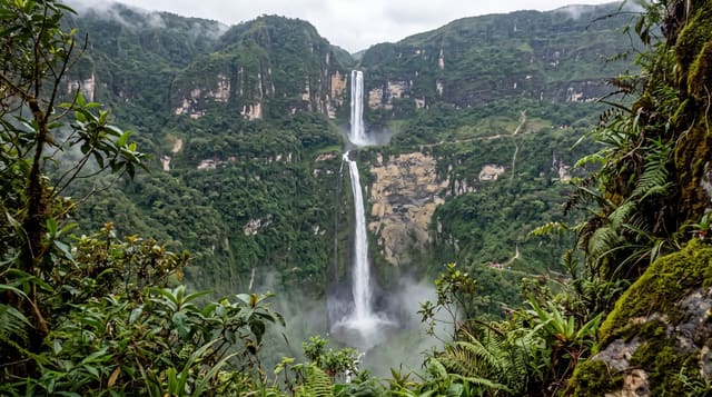
Alto Mayo protects around 180,000 hectares of montane cloud forest on the slopes above the Mayo valley, and the main highway from Rioja to Pedro Ruiz runs straight through it, which is both why it is easy to visit and why it has been so hard to protect. Birders come for a list that runs to hundreds of species including the royal sunangel, ochre-fronted antpitta and long-whiskered owlet, and the roadside feeders at Aguas Verdes and the Waqanki gardens near Moyobamba draw in hummingbirds at close range. Orchids are the other draw, with hundreds of species recorded and Moyobamba calling itself the city of orchids. The reserve has been settled by migrant farmers along the road for decades, mostly for coffee, and the response has been conservation agreements that trade support for commitments to stop clearing rather than eviction. Deforestation has slowed but not stopped.
History
The government first protected the area in 1963 as the Alto Mayo National Forest, but from the 1970s settlers cleared land inside it, and road workers hunted the yellow-tailed woolly monkey, rediscovered nearby in 1974. Research between 1974 and 1983 urged that the area be given conservation priority, the Carretera Marginal de la Selva was opened through it in 1979, and the forest was protected by decree in 1987 (Wikipedia, Alto Mayo Protection Forest).
The landscape
- The bird list - hundreds of species including royal sunangel and ochre-fronted antpitta.
- The feeders - hummingbirds at close range at Aguas Verdes and Waqanki.
- The orchids - hundreds of species in the forest above the road.
- The agreements - conservation deals with settled coffee farmers inside the reserve.
When to go
May to September is drier, though cloud forest is wet all year. Birding is best at dawn. A day for the roadside sites, several days with a lodge and guide for the specialities.
Things to know
Constant damp, mud and leeches in the forest. The highway runs through the reserve, so traffic noise reaches many sites. Sought-after birds like the owlet need patience, a guide and luck. Cleared farmland is visible throughout.
Nearby
Abra Patricia and Huembo are further up the same highway; Moyobamba is east.
Key facts
Source: Wikidata, item Q540027, read on 18 October 2026.
What to pack for Alto Mayo Protected Forest
Chosen from what this place is for. Tap a kit for the full checklist.
- Broken-in walking shoes or boots - Grip and ankle support matter more than looks; never hike in brand-new boots. Find on Amazon
- Layers + a waterproof shell - Mountain weather turns fast; a packable rain jacket saves the day. Find on Amazon
- Daypack with rain cover - 20-30 litres holds water, snacks, layers and a first-aid kit. Find on Amazon
- Offline maps + a power bank - Download the trail before you lose signal; carry backup charge. Find on Amazon
Some links on this page are Amazon affiliate links - if you buy through them we may earn a small commission at no extra cost to you.
All packing kitsPlan your trip
Where to start if Alto Mayo Protected Forest is going on the list.
Booking links on this page are affiliate links - if you book through them we may earn a small commission at no extra cost to you. It never changes what we write about a place.
Opening times, ticket prices and seasonal closures change - check the official source before you go: official site.